This advanced Unity course empowers learners to design, construct, and enhance interactive hexagonal maps using procedural generation techniques. Through six structured modules, participants will progressively apply, analyze, and synthesize concepts such as hex geometry, mesh triangulation, elevation control, and Perlin noise implementation to build dynamic terrain systems. Each module integrates hands-on practice with theoretical explanations, encouraging learners to evaluate map behavior, organize modular code structures, and develop reusable systems for real-time applications.
Unity: Design & Build Procedural Hex Maps

Unity: Design & Build Procedural Hex Maps
This course is part of Advanced Unity Projects: RPG, Level Design & VFX Specialization
Instructor: EDUCBA
Access provided by CapitalOne
Gain insight into a topic and learn the fundamentals.
1 week to complete
at 10 hours a week
Flexible schedule
Learn at your own pace
Skills you'll gain
Details to know

Shareable certificate
Add to your LinkedIn profile
Assessments
18 assignments
Taught in English
Recently updated!
August 2025
See how employees at top companies are mastering in-demand skills

Build your subject-matter expertise
This course is part of the Advanced Unity Projects: RPG, Level Design & VFX Specialization
When you enroll in this course, you'll also be enrolled in this Specialization.
- Learn new concepts from industry experts
- Gain a foundational understanding of a subject or tool
- Develop job-relevant skills with hands-on projects
- Earn a shareable career certificate

There are 6 modules in this course
This module introduces the foundational principles of creating and managing hexagonal maps in Unity. Learners will explore the theory and implementation of pointy-top hex grids, including their geometry, layout logic, and coordinate systems. The module also covers the setup of reusable structures using arrays and user interface components for interaction with the hex grid. By the end of the module, learners will be equipped to construct and visualize a scalable hexagonal grid within Unity’s 3D environment.
What's included
6 videos3 assignments
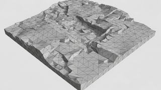
This module focuses on the core implementation of hexagonal mesh rendering and coordinate mapping within Unity. Learners will explore how to construct mesh geometry through triangulation, apply coordinate logic for accurate placement, and visualize cell data using coordinate systems and in-editor tools. By the end of this module, learners will understand how to programmatically generate, align, and debug hex tiles for a dynamic and interactive grid environment.
What's included
5 videos3 assignments
This module guides learners through the process of enhancing the visual appearance of hexagonal maps in Unity. It introduces the use of Unity's surface shaders, explores color assignment and blending techniques, and establishes a structured method for defining directions and metrics within a hex grid. Through practical implementation, learners will develop skills in applying vertex-based coloring, constructing user-friendly UI for color selection, and defining the geometric logic required for seamless visual transitions between cells.
What's included
6 videos3 assignments
This module focuses on enhancing interactivity and realism in a hexagonal grid system by integrating UI elements and elevation-based rendering. Learners will implement canvas-based user interfaces for color manipulation and visual feedback, extend mesh rendering with per-vertex color assignments, and introduce elevation to create dynamic terrain. The module also explores shading techniques and the fundamentals of representing height through geometric transformation.
What's included
6 videos3 assignments
This module focuses on advanced logic and geometry for handling elevation transitions in a hexagonal terrain system. Learners will define and apply elevation properties to individual cells, develop interpolation techniques for color blending based on terrain height, and implement slope classification using the HexEdgeType system. Through structured coding practices and visual debugging, learners will build responsive terrain meshes that adapt dynamically to changes in height and edge behavior.
What's included
7 videos3 assignments
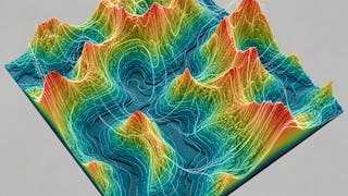
This module introduces procedural refinement techniques to enhance the visual realism of hexagonal maps. Learners will integrate Perlin noise to generate natural elevation variation, apply vertex perturbation to eliminate rigid grid patterns, and define control parameters to fine-tune terrain features. Structuring of reusable vertex data and methods for custom triangulation logic are covered, along with neighbor management and unperturbed debugging techniques to maintain control and clarity during development.
What's included
7 videos3 assignments
Earn a career certificate
Add this credential to your LinkedIn profile, resume, or CV. Share it on social media and in your performance review.
Why people choose Coursera for their career

Felipe M.
Learner since 2018
"To be able to take courses at my own pace and rhythm has been an amazing experience. I can learn whenever it fits my schedule and mood."

Jennifer J.
Learner since 2020
"I directly applied the concepts and skills I learned from my courses to an exciting new project at work."

Larry W.
Learner since 2021
"When I need courses on topics that my university doesn't offer, Coursera is one of the best places to go."

Chaitanya A.
"Learning isn't just about being better at your job: it's so much more than that. Coursera allows me to learn without limits."