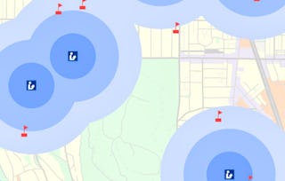
In this course, you will learn how to find GIS data for your own projects, and how to create a well-designed map that effectively communicates your message. The first section focuses on the basic building blocks of GIS data, so that you know what types of GIS files exist, and the implications of choosing one type over another. Next, we'll discuss metadata (which is information about a data set) so you know how to evaluate a data set before you decide to use it, as well as preparing data by merging and clipping files as needed. We'll then talk about how to take non-GIS data, such as a list of addresses, and convert it into "mappable" data using geocoding. Finally, you'll learn about how to take data that you have found and design a map using cartographic principles. In the course project, you will find your own data and create your own quantitative map.

GIS Data Acquisition and Map Design

GIS Data Acquisition and Map Design
This course is part of GIS, Mapping, and Spatial Analysis Specialization

Instructor: Don Boyes
Top Instructor
33,978 already enrolled
Included with
722 reviews
Skills you'll gain
Details to know

Add to your LinkedIn profile
See how employees at top companies are mastering in-demand skills

Build your subject-matter expertise
- Learn new concepts from industry experts
- Gain a foundational understanding of a subject or tool
- Develop job-relevant skills with hands-on projects
- Earn a shareable career certificate

There are 7 modules in this course
What's included
8 videos1 reading2 assignments1 discussion prompt
What's included
8 videos1 assignment1 discussion prompt
What's included
9 videos1 reading1 assignment
What's included
17 videos1 reading1 assignment
What's included
13 videos1 reading1 assignment
What's included
8 videos1 reading1 assignment
What's included
1 peer review
Earn a career certificate
Add this credential to your LinkedIn profile, resume, or CV. Share it on social media and in your performance review.
Instructor

Offered by
Explore more from Environmental Science and Sustainability
 Status: Free Trial
University of California, Davis
 Status: Free Trial
University of Toronto
 Status: Preview
 Status: Preview
École Polytechnique Fédérale de Lausanne
Why people choose Coursera for their career

Felipe M.

Jennifer J.

Larry W.

Chaitanya A.
Learner reviews
- 5 stars
89.21%
- 4 stars
8.85%
- 3 stars
1.38%
- 2 stars
0.41%
- 1 star
0.13%
Showing 3 of 722
Reviewed on Sep 5, 2020
Touched on some of the most intermediate aspects of the famed ArcGIS software. But I would request a more interactive review of the done project. Thanks anyways.
Reviewed on Aug 3, 2020
It is one of the best course of the specialization. I learned a lot about data acquisition, map design elements and principles and exporting map. It gave me a greater knowledge of map designs.
Reviewed on Jun 30, 2020
Great Course.It helps me to start as a beginner in the field of GIS. All the lectures are precise and full of practical examples.

Open new doors with Coursera Plus
Unlimited access to 10,000+ world-class courses, hands-on projects, and job-ready certificate programs - all included in your subscription
Advance your career with an online degree
Earn a degree from world-class universities - 100% online
Join over 3,400 global companies that choose Coursera for Business
Upskill your employees to excel in the digital economy
Frequently asked questions
To access the course materials, assignments and to earn a Certificate, you will need to purchase the Certificate experience when you enroll in a course. You can try a Free Trial instead, or apply for Financial Aid. The course may offer 'Full Course, No Certificate' instead. This option lets you see all course materials, submit required assessments, and get a final grade. This also means that you will not be able to purchase a Certificate experience.
When you enroll in the course, you get access to all of the courses in the Specialization, and you earn a certificate when you complete the work. Your electronic Certificate will be added to your Accomplishments page - from there, you can print your Certificate or add it to your LinkedIn profile.
Yes. In select learning programs, you can apply for financial aid or a scholarship if you can’t afford the enrollment fee. If fin aid or scholarship is available for your learning program selection, you’ll find a link to apply on the description page.
More questions
Financial aid available,
¹ Some assignments in this course are AI-graded. For these assignments, your data will be used in accordance with Coursera's Privacy Notice.

