Welcome to Remote Sensing Image Acquisition, Analysis and Applications, in which we explore the nature of imaging the earth's surface from space or from airborne vehicles.


Remote Sensing Image Acquisition, Analysis and Applications


Remote Sensing Image Acquisition, Analysis and Applications

Instructor: John Richards
19,797 already enrolled
Included with
180 reviews
Recommended experience
Skills you'll gain
- Convolutional Neural Networks
- Geospatial Information and Technology
- Classification Algorithms
- Computer Vision
- Unsupervised Learning
- Probability & Statistics
- Dimensionality Reduction
- Image Analysis
- Artificial Neural Networks
- Spatial Analysis
- Supervised Learning
- Deep Learning
- Feature Engineering
- Machine Learning
- Machine Learning Methods
Details to know

Add to your LinkedIn profile
18 assignments
See how employees at top companies are mastering in-demand skills

There are 15 modules in this course
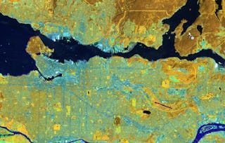
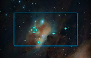
Remote sensing is the science and technology of acquiring images of the earth’s surface from spacecraft, aircraft and drones to aid in the monitoring and management of the natural and built environments. Extensive computer-based analysis techniques are used to extract information from the recorded images in support of applications ranging over many earth and information science disciplines. This course covers the fundamental nature of remote sensing and the platforms and sensor types used. It also provides an in-depth treatment of the computational algorithms employed in image understanding, ranging from the earliest historically important techniques to more recent approaches based on deep learning. The course material is extensively illustrated by examples and commentary on the how the technology is applied in practice. While broad in its coverage the 15 hours of instruction, supported by quizzes and tests, will prepare participants to use the material in their own disciplines and to undertake more detailed study in remote sensing and related topics.
What's included
6 videos4 readings1 assignment
What's included
4 videos1 assignment
What's included
5 videos1 assignment
What's included
4 videos1 assignment
What's included
3 videos1 reading2 assignments
What's included
5 videos2 readings1 assignment
What's included
6 videos1 assignment
What's included
3 videos1 assignment
What's included
5 videos1 assignment
What's included
4 videos1 reading2 assignments
What's included
6 videos2 readings1 assignment
What's included
5 videos1 assignment
What's included
4 videos1 assignment
What's included
4 videos1 assignment
What's included
7 videos1 reading2 assignments
Instructor

Explore more from Electrical Engineering
 Status: Free Trial
University of Toronto
 Status: Free Trial
MathWorks
 Status: Free Trial
MathWorks
Why people choose Coursera for their career

Felipe M.

Jennifer J.

Larry W.

Chaitanya A.
Learner reviews
- 5 stars
75%
- 4 stars
19.44%
- 3 stars
3.33%
- 2 stars
2.22%
- 1 star
0%
Showing 3 of 180
Reviewed on Jul 10, 2022
Great introduction on the topic of remote sensing! However I think certain topcis are over emphasized.
Reviewed on Jan 11, 2023
My orientation is mineral remote sensing, but in this course I got to know basic and important issues that I had used before.Thank you Dr. John Richards and Coursera for providing such a great course.
Reviewed on Aug 13, 2023
Very Informative and Comprehensive course abut Remote Sensing and Image Acquisition

Open new doors with Coursera Plus
Unlimited access to 10,000+ world-class courses, hands-on projects, and job-ready certificate programs - all included in your subscription
Advance your career with an online degree
Earn a degree from world-class universities - 100% online
Join over 3,400 global companies that choose Coursera for Business
Upskill your employees to excel in the digital economy
Frequently asked questions
To access the course materials, assignments and to earn a Certificate, you will need to purchase the Certificate experience when you enroll in a course. You can try a Free Trial instead, or apply for Financial Aid. The course may offer 'Full Course, No Certificate' instead. This option lets you see all course materials, submit required assessments, and get a final grade. This also means that you will not be able to purchase a Certificate experience.
When you purchase a Certificate you get access to all course materials, including graded assignments. Upon completing the course, your electronic Certificate will be added to your Accomplishments page - from there, you can print your Certificate or add it to your LinkedIn profile.
Yes. In select learning programs, you can apply for financial aid or a scholarship if you can’t afford the enrollment fee. If fin aid or scholarship is available for your learning program selection, you’ll find a link to apply on the description page.
More questions
Financial aid available,


