5.0
Reviewed Oct 6, 2026Learned to organize large spatial data with layers and color hierarchies. So useful!

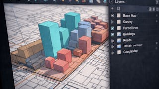
By the end of this course, learners will be able to interpret urban survey data, prepare structured AutoCAD drawings, develop urban-scale base maps, apply efficient SketchUp mapping techniques, and communicate design outcomes through professional presentations. Learners will also be able to organize large-scale spatial data using logical layers, color hierarchies, and simplified massing strategies suitable for urban analysis and visualization. This course provides a practical, end-to-end workflow for creating urban-scale maps and presentations using industry-relevant tools such as AutoCAD, SketchUp, and PowerPoint. Learners will progress from understanding real-world survey plans to building accurate 3D urban base maps and refining them for clarity and performance. The course emphasizes scalable modeling techniques, visual hierarchy, and clear communication rather than excessive detailing, making it ideal for urban design, planning, and architectural visualization contexts. What makes this course unique is its case-study-driven approach focused specifically on urban-scale mapping, not isolated buildings. Learners gain hands-on exposure to a streamlined professional workflow that bridges technical drawing, 3D mapping, and presentation skills—enabling them to produce clear, compelling urban visualizations suitable for academic, professional, and portfolio use.
Learned to organize large spatial data with layers and color hierarchies. So useful!
Focus on visual hierarchy and clarity is what makes this course unique.
Ideal for architecture and planning students. Clear, scalable techniques.
The AutoCAD to SketchUp to PowerPoint workflow is brilliantly explained
Excellent case-study-driven course! Finally learned urban-scale mapping properly.
The explanation of the AutoCAD to SketchUp to PowerPoint sequence is excellent.
From survey data to final presentation - complete end-to-end workflow.
No excessive detailing, only efficient and industry-relevant techniques. Loved it!
Great for academic and professional use. My portfolio improved drastically.
Best course for urban design visualization. Not just buildings, but whole city scale.
My urban base maps now look professional and perform smoothly.
Highly recommended for anyone in urban design and planning.
Showing: 13 of 13
Best course for urban design visualization. Not just buildings, but whole city scale.
Learned to organize large spatial data with layers and color hierarchies. So useful!
No excessive detailing, only efficient and industry-relevant techniques. Loved it!
Excellent case-study-driven course! Finally learned urban-scale mapping properly.
The explanation of the AutoCAD to SketchUp to PowerPoint sequence is excellent.
Great for academic and professional use. My portfolio improved drastically.
The best course for learning SketchUp mapping techniques for urban scale.
Ideal for architecture and planning students. Clear, scalable techniques.
Focus on visual hierarchy and clarity is what makes this course unique.
The AutoCAD to SketchUp to PowerPoint workflow is brilliantly explained
From survey data to final presentation - complete end-to-end workflow.
My urban base maps now look professional and perform smoothly.
Highly recommended for anyone in urban design and planning.