This course equips learners with the skills to utilize Python and open-source libraries for building lightweight, portable GIS desktop applications. It emphasizes practical, hands-on techniques for integrating geospatial data and tools, allowing both beginners and experienced developers to engage in advanced spatial analysis.

Python Geospatial Development Essentials
Sichern Sie sich eines unserer besten Angebote mit Coursera Plus für 199 $ (normalerweise 399 $). Jetzt sparen.

Fragen Sie Coursera
Verschaffen Sie sich einen Einblick in ein Thema und lernen Sie die Grundlagen.
Stufe Anfänger
Empfohlene Erfahrung
1 Woche zu vervollständigen
unter 10 Stunden pro Woche
Flexibler Zeitplan
In Ihrem eigenen Lerntempo lernen
Was Sie lernen werden
Design and structure a basic GIS application using existing tools
Customize Tkinter widgets to create a reusable GIS toolkit
Load, manipulate, and visualize both vector and raster spatial data
Kompetenzen, die Sie erwerben
- Kategorie: Application Deployment
- Kategorie: Data Science
- Kategorie: Application Design
- Kategorie: User Interface (UI) Design
- Kategorie: Application Development
- Kategorie: Geospatial Information and Technology
- Kategorie: Interactive Data Visualization
- Kategorie: Geospatial Mapping
- Kategorie: Spatial Analysis
- Kategorie: Code Reusability
- Kategorie: User Interface (UI)
- Kategorie: GIS Software
- Kategorie: Software Installation
- Kategorie: Spatial Data Analysis
Werkzeuge, die Sie lernen werden
- Kategorie: UI Components
- Kategorie: Geographic Information Systems
- Kategorie: Python Programming
Wichtige Details

Zertifikat zur Vorlage
Zu Ihrem LinkedIn-Profil hinzufügen
Kürzlich aktualisiert!
Januar 2026
Bewertungen
8 Aufgaben
Unterrichtet in Englisch
Erfahren Sie, wie Mitarbeiter führender Unternehmen gefragte Kompetenzen erwerben.

In diesem Kurs gibt es 8 Module
Dozent

von

Mehr von Software Development entdecken
 Status: Kostenloser Testzeitraum
 Status: Kostenloser Testzeitraum
Coursera
 Status: Kostenloser Testzeitraum
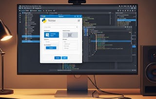 Status: Kostenloser Testzeitraum
Warum entscheiden sich Menschen für Coursera für ihre Karriere?

Felipe M.
Lernender seit 2018
„Es ist eine großartige Erfahrung, in meinem eigenen Tempo zu lernen. Ich kann lernen, wenn ich Zeit und Nerven dazu habe.“

Jennifer J.
Lernender seit 2020
„Bei einem spannenden neuen Projekt konnte ich die neuen Kenntnisse und Kompetenzen aus den Kursen direkt bei der Arbeit anwenden.“

Larry W.
Lernender seit 2021
„Wenn mir Kurse zu Themen fehlen, die meine Universität nicht anbietet, ist Coursera mit die beste Alternative.“

Chaitanya A.
„Man lernt nicht nur, um bei der Arbeit besser zu werden. Es geht noch um viel mehr. Bei Coursera kann ich ohne Grenzen lernen.“


Häufig gestellte Fragen
Weitere Fragen
Finanzielle Unterstützung verfügbar,