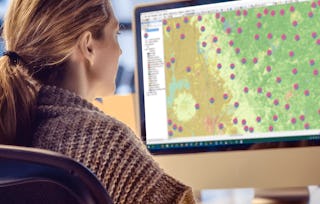
In this course, you will learn how to analyze map data using different data types and methods to answer geographic questions. First, you will learn how to filter a data set using different types of queries to find just the data you need to answer a particular question. Then, we will discuss simple yet powerful analysis methods that use vector data to find spatial relationships within and between data sets. In this section, you will also learn about how to use ModelBuilder, a simple but powerful tool for building analysis flowcharts that can then also be run as models. You will then learn how to find, understand, and use remotely sensed data such as satellite imagery, as a rich source of GIS data. You will then learn how to analyze raster data. Finally, you will complete your own project where you get to try out the new skills and tools you have learned about in this course.

Spatial Analysis and Satellite Imagery in a GIS

Spatial Analysis and Satellite Imagery in a GIS
This course is part of GIS, Mapping, and Spatial Analysis Specialization

Instructor: Don Boyes
Top Instructor
Access provided by Hokkaido University
34,325 already enrolled
631 reviews
Skills you'll gain
Tools you'll learn
Details to know

Add to your LinkedIn profile
See how employees at top companies are mastering in-demand skills

Build your subject-matter expertise
- Learn new concepts from industry experts
- Gain a foundational understanding of a subject or tool
- Develop job-relevant skills with hands-on projects
- Earn a shareable career certificate

There are 5 modules in this course
Earn a career certificate
Add this credential to your LinkedIn profile, resume, or CV. Share it on social media and in your performance review.
Instructor
Offered by

Why people choose Coursera for their career

Felipe M.

Jennifer J.

Larry W.

Chaitanya A.
Learner reviews
- 5 stars
91.61%
- 4 stars
7.12%
- 3 stars
0.79%
- 2 stars
0.15%
- 1 star
0.31%
Showing 3 of 631
Reviewed on Jan 10, 2023
It's very good experience. Spatial analysis course will help me to perform analysis smoothly.
Reviewed on Jan 1, 2023
Nice to learn about satellite images, Landsat bands and specially about the problems that we might face with this type of data.
Reviewed on Apr 2, 2024
very nicely described the topics. easy to understand and very helpful. Thank you for the course.
Explore more from Physical Science and Engineering
University of California, Davis

Coursera

¹ Some assignments in this course are AI-graded. For these assignments, your data will be used in accordance with Coursera's Privacy Notice.