Perfectionnez vos compétences en analyse spatiale et en apprentissage automatique appliqués aux données géospatiales. Ce cours aborde la géostatistique, le traitement des données LiDAR et 3D, ainsi que les techniques d’apprentissage automatique supervisé. Vous apprendrez également à appliquer des méthodes d’apprentissage profond à l’analyse d’images. À l'issue de ce cours, vous serez capable de construire et d'évaluer des modèles pour les données géospatiales, ainsi que d'analyser des structures spatiales complexes.
Analyse spatiale, données 3D et apprentissage automatique
Obtenez l'une de nos meilleures offres avec Coursera Plus pour 199 $ (habituellement 399 $). Économisez maintenant.
Analyse spatiale, données 3D et apprentissage automatique
Ce cours fait partie de Spécialisation "Maîtriser la science des données géospatiales : Du débutant à l'expert"

Instructeur : Professionals from the Industry
Inclus avec
Obtenez un aperçu d'un sujet et apprenez les principes fondamentaux.
niveau Débutant
Expérience recommandée
1 semaine à compléter
à 10 heures par semaine
Planning flexible
Apprenez à votre propre rythme
Ce que vous apprendrez
Appliquer les statistiques spatiales et les techniques d'interpolation
Travailler avec des données LiDAR et des données géospatiales en 3D
Entraîner des modèles d'apprentissage automatique sur des ensembles de données géospatiales
Utiliser l'apprentissage profond pour la classification d'images
Compétences que vous acquerrez
- Catégorie : Analyse d'images
- Catégorie : Apprentissage profond
- Catégorie : Analyse des données
- Catégorie : Information et technologie géospatiales
- Catégorie : Réseaux neuronaux convolutifs
- Catégorie : Ingénierie des fonctionnalités
- Catégorie : Cartographie géospatiale
- Catégorie : Mise au point
- Catégorie : Analyse des données spatiales
- Catégorie : Modèle de formation
- Catégorie : Apprentissage automatique appliqué
- Catégorie : Méthodes d'apprentissage automatique
- Catégorie : Géostatistique
- Catégorie : Analyse spatiale
- Catégorie : Apprentissage automatique
- Catégorie : Traitement des données
- Catégorie : Évaluation du modèle
- Catégorie : Algorithme de la forêt aléatoire
Outils que vous découvrirez
- Catégorie : Systèmes d'information géographique
Détails à connaître

Certificat partageable
Ajouter à votre profil LinkedIn
Récemment mis à jour !
avril 2026
Enseigné en Anglais
Découvrez comment les employés des entreprises prestigieuses maîtrisent des compétences recherchées

Élaborez votre expertise du sujet
Ce cours fait partie de la Spécialisation "Maîtriser la science des données géospatiales : Du débutant à l'expert"
Lorsque vous vous inscrivez à ce cours, vous êtes également inscrit(e) à cette Spécialisation.
- Apprenez de nouveaux concepts auprès d'experts du secteur
- Acquérez une compréhension de base d'un sujet ou d'un outil
- Développez des compétences professionnelles avec des projets pratiques
- Obtenez un certificat professionnel partageable

Il y a 13 modules dans ce cours
Obtenez un certificat professionnel
Ajoutez ce titre à votre profil LinkedIn, à votre curriculum vitae ou à votre CV. Partagez-le sur les médias sociaux et dans votre évaluation des performances.
Instructeur
479 Cours109 487 apprenants
Offert par
En savoir plus sur Apprentissage automatique
 Statut : Essai gratuit
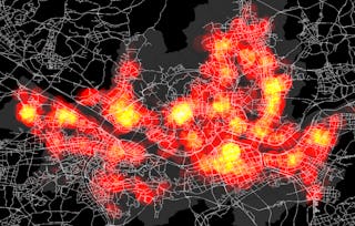 Statut : Prévisualisation
Yonsei University
 Statut : Essai gratuit
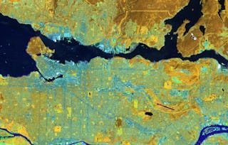 Statut : Essai gratuit
University of Toronto
Pour quelles raisons les étudiants sur Coursera nous choisissent-ils pour leur carrière ?

Felipe M.
Étudiant(e) depuis 2018
’Pouvoir suivre des cours à mon rythme à été une expérience extraordinaire. Je peux apprendre chaque fois que mon emploi du temps me le permet et en fonction de mon humeur.’

Jennifer J.
Étudiant(e) depuis 2020
’J'ai directement appliqué les concepts et les compétences que j'ai appris de mes cours à un nouveau projet passionnant au travail.’

Larry W.
Étudiant(e) depuis 2021
’Lorsque j'ai besoin de cours sur des sujets que mon université ne propose pas, Coursera est l'un des meilleurs endroits où se rendre.’

Chaitanya A.
’Apprendre, ce n'est pas seulement s'améliorer dans son travail : c'est bien plus que cela. Coursera me permet d'apprendre sans limites.’

Foire Aux Questions
Plus de questions
Aide financière disponible,
¹ Certains travaux de ce cours sont notés par l'IA. Pour ces travaux, vos Données internes seront utilisées conformément à Notification de confidentialité de Coursera.