All Results
 Status: Free Trial
L&T EduTech
Skills you'll gain: Construction Engineering, Geospatial Mapping, Geospatial Information and Technology, Geographic Information Systems, Spatial Data Analysis, Construction, Construction Management, Visualization (Computer Graphics), Civil and Architectural Engineering, Spatial Analysis, Global Positioning Systems, GIS Software, Survey Creation, Engineering, Scientific, and Technical Instruments, 3D Modeling
 Status: Free Trial
MathWorks
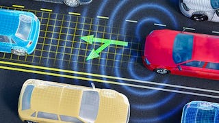
Skills you'll gain: Computer Vision, Model Evaluation, Image Analysis, Model Deployment, Anomaly Detection, Convolutional Neural Networks, Transfer Learning, Model Training, Fine-tuning, Deep Learning, Machine Learning Methods, Image Quality, Generative AI, Data Preprocessing, Artificial Neural Networks, Matlab, Applied Machine Learning, Machine Learning, Classification Algorithms, Software Visualization
 Status: NewStatus: Free Trial
Skills you'll gain: Spatial Data Analysis, Geographic Information Systems, GIS Software, Geospatial Information and Technology, Spatial Analysis, Geospatial Mapping, Metadata Management, Geostatistics, Data Validation, Query Languages, Technical Documentation, Document Management, SQL, Data Import/Export, Visual Design, Data Quality, PostgreSQL, Data Management, Data Transformation, Python Programming
 Status: Free Trial
Vanderbilt University
Skills you'll gain: AI powered creativity, ChatGPT, Generative AI, AI literacy, Image Analysis, Organizational Skills, Computer Vision, Multimodal Prompts, Email Automation, Artificial Intelligence, Prompt Engineering, Cooking
 Status: Free Trial
Case Western Reserve University
Skills you'll gain: Geostatistics, Exploratory Data Analysis, Spatial Data Analysis, Spatial Analysis, Geospatial Mapping, Geospatial Information and Technology, Statistical Methods, Statistical Modeling, R Programming, Statistical Analysis, R (Software), Probability & Statistics, Descriptive Statistics, Data Analysis, Data-Driven Decision-Making, Correlation Analysis, Data Validation, Simulations, Histogram, Box Plots
 Status: Free
Skills you'll gain: PyTorch (Machine Learning Library), Convolutional Neural Networks, Fine-tuning, Transfer Learning, Model Evaluation, Image Analysis, Model Training, Computer Vision, Applied Machine Learning, Deep Learning, Python Programming
What brings you to Coursera today?
 Status: Free Trial
Dassault Systèmes
Skills you'll gain: SolidWorks (CAD), Computer-Aided Design, Drafting and Engineering Design, Mechanical Engineering
 Status: NewStatus: Free Trial
Skills you'll gain: Spatial Data Analysis, Spatial Analysis, Geographic Information Systems, Random Forest Algorithm, Model Evaluation, Feature Engineering, Model Training, Matplotlib, Convolutional Neural Networks, Image Analysis, Applied Machine Learning, Plot (Graphics), Supervised Learning, Environmental Monitoring, Geospatial Information and Technology, Scientific Visualization, Predictive Modeling, Deep Learning, Geospatial Mapping, Machine Learning
 Status: NewStatus: Free Trial
Skills you'll gain: Geospatial Information and Technology, Interactive Data Visualization, Geospatial Mapping, Geographic Information Systems, Graphic and Visual Design, Spatial Data Analysis, Design Elements And Principles, Generative AI, Color Theory, AI Workflows, Usability
 Status: Free Trial
Skillshare
Skills you'll gain: Photography, Photo Editing, Photo/Video Production and Technology, Visual Storytelling, Storytelling, Geospatial Information and Technology, Geospatial Mapping, Geographic Information Systems, GIS Software, Global Positioning Systems, Creativity, Spatial Data Analysis, Post-Production, Planning, Research, Adobe Creative Cloud, Design Elements And Principles, Aesthetics, Critical Thinking, Editing
 Status: NewStatus: Free Trial
Skills you'll gain: Leaflet (Software), Data Visualization, Extract, Transform, Load, Interactive Data Visualization, Datamaps, Data Pipelines, Data Presentation, Dashboard Creation, Spatial Data Analysis, Heat Maps, Apache Airflow, GIS Software, Geographic Information Systems, Geospatial Information and Technology, Metadata Management, Data Mapping, Spatial Analysis, Technical Documentation, Geospatial Mapping, Cloud Computing
 Status: NewStatus: Free Trial
Skills you'll gain: Photo Editing, Photography, Visual Storytelling, Storytelling, Editing, Geospatial Information and Technology, Geospatial Mapping, Geographic Information Systems, GIS Software, Image Quality, Global Positioning Systems, Spatial Data Analysis, Post-Production, Planning, Research, Photo/Video Production and Technology, Adobe Creative Cloud, Creativity, Design Elements And Principles, Critical Thinking