Acquérez des bases solides en science des données géospatiales en apprenant les concepts fondamentaux du SIG et l'analyse des données vectorielles. Ce cours présente les systèmes de référence de coordonnées, les types de données spatiales et les applications concrètes du SIG. Vous mettrez en place un environnement géospatial sous Python et utiliserez GeoPandas pour effectuer des opérations spatiales telles que les jointures, les projections et la synthèse des données. Vous découvrirez également les bonnes pratiques en matière de gestion de projets géospatiaux, notamment les métadonnées et les contrôles de qualité des données. À l'issue de ce cours, vous serez capable de travailler avec des données vectorielles et d'effectuer des tâches essentielles d'analyse géospatiale.
Fondements géospatiaux et analyse vectorielle
Obtenez l'une de nos meilleures offres avec Coursera Plus pour 199 $ (habituellement 399 $). Économisez maintenant.
Fondements géospatiaux et analyse vectorielle
Ce cours fait partie de Spécialisation "Maîtriser la science des données géospatiales : Du débutant à l'expert"

Instructeur : Professionals from the Industry
Inclus avec
Expérience recommandée
Ce que vous apprendrez
Comprendre les concepts liés aux SIG, aux systèmes de coordonnées et aux types de données spatiales.
Configurer l'environnement Python pour l'analyse géospatiale
Analyser des données vectorielles à l'aide de GeoPandas
Gérer les données géospatiales et effectuer des contrôles de qualité
Compétences que vous acquerrez
- Catégorie : Gestion des métadonnées
- Catégorie : Installation du logiciel
- Catégorie : Validation des données
- Catégorie : Environnement de développement
- Catégorie : Analyse spatiale
- Catégorie : Vérification et validation
- Catégorie : Information et technologie géospatiales
- Catégorie : Qualité des données
- Catégorie : Cartographie géospatiale
- Catégorie : Logiciel SIG
- Catégorie : Gestion des fichiers
- Catégorie : Gestion des paquets et des logiciels
- Catégorie : Analyse des données spatiales
Outils que vous découvrirez
- Catégorie : Systèmes d'information géographique
Détails à connaître

Ajouter à votre profil LinkedIn
avril 2026
Découvrez comment les employés des entreprises prestigieuses maîtrisent des compétences recherchées

Élaborez votre expertise du sujet
- Apprenez de nouveaux concepts auprès d'experts du secteur
- Acquérez une compréhension de base d'un sujet ou d'un outil
- Développez des compétences professionnelles avec des projets pratiques
- Obtenez un certificat professionnel partageable

Il y a 12 modules dans ce cours
Obtenez un certificat professionnel
Ajoutez ce titre à votre profil LinkedIn, à votre curriculum vitae ou à votre CV. Partagez-le sur les médias sociaux et dans votre évaluation des performances.
Instructeur
Offert par
En savoir plus sur Analyse des données
 Statut : Essai gratuit
 Statut : Essai gratuit
Coursera
 Statut : Essai gratuit
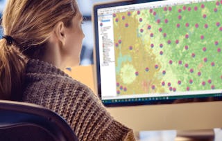 Statut : Essai gratuit
University of California, Davis
Pour quelles raisons les étudiants sur Coursera nous choisissent-ils pour leur carrière ?

Felipe M.

Jennifer J.

Larry W.

Chaitanya A.


Foire Aux Questions
Plus de questions
Aide financière disponible,
¹ Certains travaux de ce cours sont notés par l'IA. Pour ces travaux, vos Données internes seront utilisées conformément à Notification de confidentialité de Coursera.