Cartography Courses
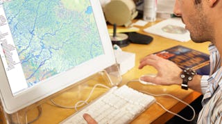
Cartography courses can help you learn map design, spatial analysis, data visualization, and geographic information systems (GIS). You can build skills in interpreting topographic features, understanding coordinate systems, and applying cartographic principles to create effective visual representations. Many courses introduce tools like ArcGIS and QGIS, that support analyzing geographic data and producing detailed maps that communicate information clearly.
Popular Cartography Courses and Certifications
 Status: Free Trial
University of California, Davis
Skills you'll gain: ArcGIS, GIS Software, Spatial Data Analysis, Spatial Analysis, Data Storytelling, Geographic Information Systems, Data Presentation, Geospatial Information and Technology, Geospatial Mapping, Public Health and Disease Prevention, Data Sharing, Public Health, Land Management, Heat Maps, Geostatistics, Epidemiology, Community Health, Image Analysis, Land Development, Project Management
 Status: Free Trial
University of Toronto
Skills you'll gain: ArcGIS, GIS Software, Spatial Data Analysis, Spatial Analysis, Geographic Information Systems, Geospatial Information and Technology, Geospatial Mapping, Data Mapping, Metadata Management, Query Languages, Data Manipulation, Data Visualization, Quantitative Research, Data Compilation, Data Literacy, Data Access, Interactive Data Visualization, Data Processing, Typography, Data Wrangling
 Status: Free Trial
University of California, Davis
Skills you'll gain: ArcGIS, GIS Software, Geographic Information Systems, Geospatial Information and Technology, Data Sharing, Geospatial Mapping, Spatial Analysis, Metadata Management, Data Quality, Data Mapping, Data Visualization, Data Visualization Software, Data Analysis
 Status: Free Trial
University of Toronto
Skills you'll gain: ArcGIS, GIS Software, Spatial Data Analysis, Geographic Information Systems, Geospatial Information and Technology, Spatial Analysis, Geospatial Mapping, Data Mapping, File Management
 Status: NewStatus: Free Trial
Coursera
Skills you'll gain: Data Visualization, Datamaps, Data Presentation, Data Mapping, Color Theory, Design, Visual Design, Graphic and Visual Design, Layout Design, Design Elements And Principles, Geospatial Mapping, Design Strategies
 Status: Free Trial
Skillshare
Skills you'll gain: Photography, Photo Editing, Photo/Video Production and Technology, Visual Storytelling, Storytelling, Geospatial Information and Technology, Geospatial Mapping, Geographic Information Systems, GIS Software, Global Positioning Systems, Creativity, Spatial Data Analysis, Post-Production, Planning, Research, Adobe Creative Cloud, Design Elements And Principles, Aesthetics, Critical Thinking, Editing
What brings you to Coursera today?
 Status: Preview
Skills you'll gain: Geographic Information Systems, Geospatial Information and Technology, GIS Software, Geospatial Mapping, Spatial Data Analysis, Spatial Analysis, Global Positioning Systems, Data Analysis, Data Integration, Decision Support Systems
 Status: Free Trial
University of Toronto
Skills you'll gain: Spatial Data Analysis, Spatial Analysis, Geographic Information Systems, Geospatial Mapping, ArcGIS, Geospatial Information and Technology, GIS Software, Data Manipulation, Data Visualization, Data Compilation, Interactive Data Visualization, Data Processing, Data Wrangling, Data Mapping, Data Storytelling, Metadata Management, Data Integration, Graphic and Visual Design, Design Elements And Principles
 Status: NewStatus: Free Trial
Skills you'll gain: Data Storytelling, Data Presentation, Data Visualization, Statistical Visualization, Scatter Plots, Strategic Decision-Making
 Status: Free
École normale supérieure
Skills you'll gain: Infographics, Statistical Visualization, Geospatial Mapping, Data Mapping, Geospatial Information and Technology, Graphic and Visual Design, Geographic Information Systems, Graphical Tools, Data Presentation, Color Theory, Layout Design, Design Elements And Principles, Descriptive Statistics
 Status: Preview
Universitat de Barcelona
Skills you'll gain: Hydrology, Physical Science, Water Resources, Geospatial Information and Technology, Environmental Monitoring, Chemistry, Environment, Environmental Science, Biology, Climate Change Mitigation
 Status: Free Trial
California Institute of the Arts
Skills you'll gain: Typography, Graphic Design, Graphic and Visual Design, Layout Design, Design, Art History, Visual Design, Information Architecture, Design Elements And Principles, Design Strategies, Design Research, Peer Review, Creativity
In summary, here are 10 of our most popular cartography courses
- Geographic Information Systems (GIS): University of California, Davis
- GIS, Mapping, and Spatial Analysis: University of Toronto
- Fundamentals of GIS: University of California, Davis
- Introduction to GIS Mapping: University of Toronto
- Design Stunning Maps: Coursera
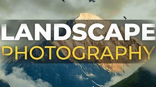
- Landscape Photography: Skillshare
- GIS Mastery: Spatial Data, Remote Sensing, Decision Support: Coursera
- GIS, Mapping, and Spatial Analysis Capstone: University of Toronto
- Charts: Visualize Data Like a Pro: Coursera
- Cartographie thématique: École normale supérieure


