All Results

University of Illinois Urbana-Champaign
Skills you'll gain: Geospatial Information and Technology, Geographic Information Systems, Apache Hadoop, Spatial Data Analysis, Geospatial Mapping, Spatial Analysis, Big Data, Matplotlib, Data Processing, Computational Thinking, Distributed Computing, Data Manipulation, Theoretical Computer Science, Python Programming

Skills you'll gain: GIS Software, Model Evaluation, Geographic Information Systems, Extract, Transform, Load, Spatial Analysis, Spatial Data Analysis, Geospatial Mapping, Data Pipelines, Geospatial Information and Technology, Apache Airflow, Geostatistics, Interactive Data Visualization, Cloud Computing, Leaflet (Software), Google Cloud Platform, Environmental Monitoring, Model Training, Graphic and Visual Design, Pandas (Python Package), Python Programming
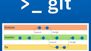
Skills you'll gain: Git (Version Control System), GitHub, Version Control, Collaborative Software, Software Versioning, Open Source Technology, Command-Line Interface, DevOps

Skills you'll gain: Spatial Data Analysis, Geographic Information Systems, GIS Software, Geospatial Information and Technology, Spatial Analysis, Geospatial Mapping, Metadata Management, Geostatistics, Data Validation, Query Languages, Technical Documentation, Document Management, SQL, Data Import/Export, Visual Design, Data Quality, PostgreSQL, Data Management, Data Transformation, Python Programming

Skills you'll gain: Debugging, Go (Programming Language), Application Development, Program Development, Build Tools, Development Environment, Microsoft Visual Studio, Integrated Development Environments, Software Development Tools, Software Installation, Programming Principles, Other Programming Languages, Command-Line Interface, Package and Software Management

University of California, Davis
Skills you'll gain: ArcGIS, GIS Software, Spatial Data Analysis, Spatial Analysis, Data Storytelling, Geographic Information Systems, Data Presentation, Geospatial Information and Technology, Geospatial Mapping, Public Health and Disease Prevention, Data Sharing, Public Health, Land Management, Heat Maps, Geostatistics, Epidemiology, Community Health, Image Analysis, Land Development, Project Management
What brings you to Coursera today?

Skills you'll gain: Prompt Engineering, Generative AI, Generative Model Architectures, Generative Adversarial Networks (GANs), LLM Application, Fine-tuning, Large Language Modeling, Model Optimization, Artificial Intelligence and Machine Learning (AI/ML), Responsible AI, Embeddings, Data Preprocessing, AI Personalization, Deep Learning, Open Source Technology, Data Processing, Machine Learning, Data Cleansing, Data Visualization, Database Systems

Coursera
Skills you'll gain: GIS Software, Geospatial Mapping, Geographic Information Systems, Spatial Data Analysis, Spatial Analysis, Geospatial Information and Technology, Database Systems, SQL, PostgreSQL, Data Validation, Query Languages, Data Integration, Data Mapping, Scripting, Performance Tuning
Skills you'll gain: Geospatial Information and Technology, Environmental Monitoring, Spatial Data Analysis, Model Evaluation, Geographic Information Systems, GIS Software, Data Processing, Spatial Analysis, Image Analysis, Environmental Science, Data Analysis, Data Transformation, Verification And Validation, Technical Communication
Skills you'll gain: GIS Software, Geographic Information Systems, Spatial Data Analysis, Geospatial Information and Technology, Spatial Analysis, Geospatial Mapping, Data Validation, Metadata Management, Data Quality, Verification And Validation, File Management, Package and Software Management, Development Environment, Software Installation
Google Cloud
Skills you'll gain: Infrastructure as Code (IaC), Terraform, Google Cloud Platform, Cloud Infrastructure, Cloud Management, Cloud Storage, Command-Line Interface, Code Reusability, Configuration Management, Dependency Analysis

University of Michigan
Skills you'll gain: Sustainable Development, Sustainable Systems, Geographic Information Systems, Geospatial Information and Technology, GIS Software, Geospatial Mapping, Spatial Data Analysis, Datamaps, Spatial Analysis, Interactive Data Visualization, Data Storytelling, Environmental Monitoring, Data Visualization, Data Presentation, Forecasting, Trend Analysis