QGIS Courses
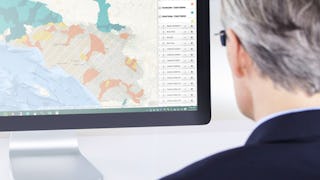
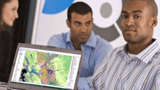
QGIS courses can help you learn geographic information systems, spatial analysis, data visualization, and cartography techniques. You can build skills in managing geographic data, creating detailed maps, and analyzing spatial relationships. Many courses introduce tools like QGIS software, which allows you to manipulate and visualize geospatial data effectively, along with methods for conducting field surveys and integrating various data sources.
Popular QGIS Courses and Certifications
 Status: NewStatus: Free Trial
Coursera
Skills you'll gain: Data Visualization, Datamaps, Data Presentation, Data Mapping, Color Theory, Design, Visual Design, Graphic and Visual Design, Layout Design, Design Elements And Principles, Geospatial Mapping, Design Strategies
 Status: Free Trial
University of California, Davis
Skills you'll gain: Spatial Analysis, ArcGIS, Geospatial Information and Technology, Geographic Information Systems, Geospatial Mapping, GIS Software, Data Quality, Data Mapping, Data Modeling, Database Design, Data Storage Technologies, Data Management, Data Storage, Data Sharing, Data Manipulation, Data Capture, Relational Databases, Query Languages, Analytics
 Status: Free Trial
University of California, Davis
Skills you'll gain: ArcGIS, GIS Software, Geographic Information Systems, Public Health and Disease Prevention, Public Health, Land Management, Geospatial Information and Technology, Geospatial Mapping, Spatial Analysis, Epidemiology, Community Health, Spatial Data Analysis, Land Development, Social Determinants Of Health, Emergency Response, Environmental Science, Natural Resource Management, Emergency Services, Business Development, Environment and Resource Management
 Status: Free Trial
Case Western Reserve University
Skills you'll gain: Geostatistics, Exploratory Data Analysis, Spatial Analysis, Spatial Data Analysis, Descriptive Statistics, Box Plots, Geospatial Mapping, Statistical Modeling, Geospatial Information and Technology, R Programming, Plot (Graphics), Rmarkdown, Data Analysis, Data Cleansing, Statistical Methods, R (Software), Statistical Programming, Data Wrangling, Simulations, Package and Software Management
 Status: Preview
École Polytechnique Fédérale de Lausanne
Skills you'll gain: Spatial Analysis, Spatial Data Analysis, GIS Software, Geospatial Information and Technology, Geographic Information Systems, Geospatial Mapping, Geostatistics, Interactive Data Visualization, Data Integration, Data Mapping, Augmented Reality, Statistical Analysis, Sampling (Statistics)
 Status: NewStatus: Free Trial
Coursera
Skills you'll gain: GIS Software, Geospatial Mapping, Geographic Information Systems, Spatial Data Analysis, Spatial Analysis, Geospatial Information and Technology, Database Systems, SQL, PostgreSQL, Data Validation, Query Languages, Data Integration, Data Mapping, Scripting, Performance Tuning
 Status: NewStatus: Free Trial
Skills you'll gain: Geospatial Information and Technology, Interactive Data Visualization, Geospatial Mapping, Geographic Information Systems, Graphic and Visual Design, Spatial Data Analysis, Design Elements And Principles, Generative AI, Color Theory, AI Workflows, Usability
 Status: NewStatus: Free Trial
Skills you'll gain: Prompt Engineering, Lean Six Sigma, Pareto Chart, Six Sigma Methodology, Statistical Process Controls, Regression Analysis, Quality Improvement, Generative AI, Quality Monitoring, Quality Management, Process Improvement, ChatGPT, Data Analysis, Lean Methodologies, Customer Insights, Analysis, Statistical Analysis, Data-Driven Decision-Making, Statistical Methods
 Status: Free Trial
Skills you'll gain: UI Components, Interactive Design, User Interface (UI), Frontend Integration, MySQL, Object Oriented Programming (OOP), Event-Driven Programming, Database Development, Database Design, Graphic and Visual Design, Database Application, User Flows, Application Deployment, User Interface (UI) Design, Application Development, Database Management, Application Design, Graphical Tools, Development Environment, Python Programming
 Status: NewStatus: Free Trial
Skills you'll gain: GIS Software, Geographic Information Systems, Spatial Data Analysis, Geospatial Information and Technology, Spatial Analysis, Geospatial Mapping, Data Validation, Metadata Management, Data Quality, Verification And Validation, File Management, Package and Software Management, Development Environment, Software Installation
 Status: NewStatus: Free Trial
Coursera
Skills you'll gain: Extract, Transform, Load, Data Pipelines, Geospatial Information and Technology, Apache Airflow, Geospatial Mapping, Spatial Data Analysis, GIS Software, Cloud Computing, Geographic Information Systems, Leaflet (Software), Google Cloud Platform, Real Time Data, Global Positioning Systems, Data Transformation, Data Analysis, Anomaly Detection, Technical Communication, Machine Learning
 Status: NewStatus: Free Trial
Skills you'll gain: AWS SageMaker, AI Integrations, Amazon Web Services, AI Security, AI Enablement, DevOps, IT Automation, Devops Tools, AI Workflows, AWS CloudFormation, AI literacy, Vulnerability Scanning, Artificial Intelligence, Secure Coding, Generative AI Agents, Generative AI, Application Security, Responsible AI, Extract, Transform, Load, Building Codes
In summary, here are 10 of our most popular qgis courses
- Design Stunning Maps: Coursera
- GIS Data Formats, Design and Quality: University of California, Davis
- GIS Applications Across Industries: University of California, Davis
- Using R for Geostatistical Geospatial Modeling : Case Western Reserve University
- Geographical Information Systems - Part 2: École Polytechnique Fédérale de Lausanne
- Desktop GIS & Spatial Databases: Coursera
- Visualization, Web Mapping & Cloud GIS: Coursera
- Smarter Processes – ChatGPT for Lean Six Sigma: Packt
- Python GUI Development with PyQt: EDUCBA
- Geospatial Foundations & Vector Analysis : Coursera


