• For Individuals
  • For Businesses
  • For Universities
  • For Governments
Degrees
​
Log In
Join for Free
  • Browse
  • Qgis

QGIS Courses

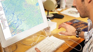
QGIS courses can help you learn geographic information systems, spatial analysis, data visualization, and cartography techniques. You can build skills in managing geographic data, creating detailed maps, and analyzing spatial relationships. Many courses introduce tools like QGIS software, which allows you to manipulate and visualize geospatial data effectively, along with methods for conducting field surveys and integrating various data sources.


Popular QGIS Courses and Certifications


  • Status: Free Trial
    Free Trial
    L

    L&T EduTech

    Mastering Geospatial Analysis with QGIS

    Skills you'll gain: Spatial Analysis, GIS Software, Spatial Data Analysis, Geospatial Mapping, Geographic Information Systems, Building Information Modeling, Data Manipulation, Global Positioning Systems, Network Analysis, Image Analysis, Data Import/Export, Unsupervised Learning, Software Installation, Supervised Learning, UI Components

    4
    Rating, 4 out of 5 stars
    ·
    42 reviews

    Advanced · Course · 1 - 3 Months

  • Status: Free Trial
    Free Trial
    U

    University of Toronto

    GIS, Mapping, and Spatial Analysis

    Skills you'll gain: ArcGIS, Spatial Data Analysis, Spatial Analysis, Geographic Information Systems, Geospatial Mapping, GIS Software, Data Mapping, Geospatial Information and Technology, Data Visualization, Metadata Management, Query Languages, Global Positioning Systems, Quantitative Research, Data Compilation, Typography, Data Manipulation, Data Storytelling, Data Modeling, Design Elements And Principles, Image Analysis

    4.8
    Rating, 4.8 out of 5 stars
    ·
    3.1K reviews

    Beginner · Specialization · 3 - 6 Months

  • Status: Free Trial
    Free Trial
    U

    University of California, Davis

    Fundamentals of GIS

    Skills you'll gain: ArcGIS, GIS Software, Geographic Information Systems, Data Sharing, Spatial Analysis, Metadata Management, Data Quality, Data Visualization, Data Visualization Software, Data Analysis, File Management

    4.8
    Rating, 4.8 out of 5 stars
    ·
    5.9K reviews

    Beginner · Course · 1 - 4 Weeks

  • Status: Free Trial
    Free Trial
    U

    University of California, Davis

    Geographic Information Systems (GIS)

    Skills you'll gain: ArcGIS, GIS Software, Spatial Analysis, Data Storytelling, Spatial Data Analysis, Geographic Information Systems, Data Presentation, Geospatial Information and Technology, Geospatial Mapping, Public Health and Disease Prevention, Data Sharing, Public Health, Land Management, Heat Maps, Epidemiology, Community Health, Image Analysis, Project Management, Data Visualization Software, Data Quality

    4.8
    Rating, 4.8 out of 5 stars
    ·
    6.4K reviews

    Beginner · Specialization · 3 - 6 Months

  • Status: Free Trial
    Free Trial
    U

    University of Michigan

    GIS: Geographic Information Systems for Sustainability

    Skills you'll gain: Sustainable Development, Geographic Information Systems, Geospatial Mapping, Sustainability Reporting, Spatial Data Analysis, Sustainable Business, Spatial Analysis, Data Storytelling, Environmental Monitoring, Data Visualization, Stakeholder Engagement, Trend Analysis, Decision Making

    4.5
    Rating, 4.5 out of 5 stars
    ·
    17 reviews

    Beginner · Course · 1 - 4 Weeks

  • Status: Free Trial
    Free Trial
    U

    University of Toronto

    Introduction to GIS Mapping

    Skills you'll gain: ArcGIS, Spatial Data Analysis, Geographic Information Systems, Spatial Analysis, Geospatial Mapping, Data Mapping, Global Positioning Systems, Data Capture

    4.8
    Rating, 4.8 out of 5 stars
    ·
    2.3K reviews

    Beginner · Course · 1 - 3 Months

What brings you to Coursera today?

  • Status: Free Trial
    Free Trial
    U

    University of Toronto

    Spatial Analysis and Satellite Imagery in a GIS

    Skills you'll gain: Geographic Information Systems, GIS Software, Spatial Analysis, Spatial Data Analysis, Geospatial Information and Technology, Geospatial Mapping, Query Languages, Data Manipulation, Image Analysis

    4.9
    Rating, 4.9 out of 5 stars
    ·
    626 reviews

    Beginner · Course · 1 - 3 Months

  • Status: Free Trial
    Free Trial
    L

    L&T EduTech

    Geospatial Techniques for Engineers

    Skills you'll gain: Geospatial Information and Technology, Spatial Analysis, GIS Software, Spatial Data Analysis, Geographic Information Systems, Geospatial Mapping, Construction Engineering, Database Management, Construction, Construction Management, Architecture and Construction, Global Positioning Systems, Visualization (Computer Graphics), Civil and Architectural Engineering, Decision Support Systems, Building Information Modeling, Survey Creation, AutoCAD Civil 3D, Data Manipulation, Network Analysis

    4.3
    Rating, 4.3 out of 5 stars
    ·
    71 reviews

    Advanced · Specialization · 3 - 6 Months

  • Status: Free Trial
    Free Trial
    C

    Case Western Reserve University

    Practical Geospatial Geostatistical Modeling

    Skills you'll gain: Exploratory Data Analysis, Spatial Data Analysis, Spatial Analysis, Geospatial Mapping, Geospatial Information and Technology, Descriptive Statistics, Statistical Modeling, R Programming, Geographic Information Systems, Statistical Analysis, Probability & Statistics, Data-Driven Decision-Making, Oil and Gas, Data Analysis, Simulations, Statistical Methods, Rmarkdown, Data Cleansing, Box Plots, Plot (Graphics)

    Intermediate · Specialization · 3 - 6 Months

  • Status: Preview
    Preview
    C

    Coursera

    GIS Mastery: Spatial Data, Remote Sensing, Decision Support

    Skills you'll gain: Geographic Information Systems, Geospatial Mapping, Spatial Data Analysis, Spatial Analysis, Global Positioning Systems, Data Analysis, Metadata Management, Decision Support Systems

    4.7
    Rating, 4.7 out of 5 stars
    ·
    24 reviews

    Intermediate · Course · 1 - 4 Weeks

  • Status: New
    New
    Status: Preview
    Preview
    E

    EDUCBA

    Analyze and Build Dashboards Using AWS QuickSight

    Skills you'll gain: Cloud-Native Computing, Business Intelligence Software, Amazon Web Services, Data Manipulation, Data Import/Export

    Beginner · Course · 1 - 4 Weeks

  • Status: Free Trial
    Free Trial
    U

    University of Toronto

    GIS Data Acquisition and Map Design

    Skills you'll gain: Geographic Information Systems, Geospatial Mapping, Data Mapping, Spatial Data Analysis, Data Visualization, Metadata Management, Quantitative Research, Spatial Analysis, Typography, Data Manipulation, Data Modeling, Design Elements And Principles, Data Import/Export

    4.9
    Rating, 4.9 out of 5 stars
    ·
    722 reviews

    Beginner · Course · 1 - 3 Months

Searches related to qgis

qgis free
qgis course
qgis software
mastering geospatial analysis with qgis
free qgis
gis qgis
python qgis
formation qgis
1234…9

In summary, here are 10 of our most popular qgis courses

  • Mastering Geospatial Analysis with QGIS: L&T EduTech
  • GIS, Mapping, and Spatial Analysis: University of Toronto
  • Fundamentals of GIS: University of California, Davis
  • Geographic Information Systems (GIS): University of California, Davis
  • GIS: Geographic Information Systems for Sustainability: University of Michigan
  • Introduction to GIS Mapping: University of Toronto
  • Spatial Analysis and Satellite Imagery in a GIS: University of Toronto
  • Geospatial Techniques for Engineers: L&T EduTech
  • Practical Geospatial Geostatistical Modeling: Case Western Reserve University
  • GIS Mastery: Spatial Data, Remote Sensing, Decision Support: Coursera

Frequently Asked Questions about Qgis

QGIS, or Quantum Geographic Information System, is an open-source geographic information system that allows users to create, edit, visualize, analyze, and publish geospatial information. It is important because it provides powerful tools for mapping and spatial analysis, making it accessible for individuals and organizations to work with geographic data. QGIS is widely used in various fields such as urban planning, environmental science, and resource management, enabling informed decision-making based on spatial data.‎

With skills in QGIS, you can pursue various job roles, including GIS Analyst, Cartographer, Urban Planner, Environmental Consultant, and Data Scientist. These positions often involve analyzing spatial data, creating maps, and providing insights that help organizations make data-driven decisions. The demand for professionals skilled in QGIS continues to grow as more industries recognize the value of geographic data in their operations.‎

To learn QGIS effectively, you should focus on developing skills in spatial analysis, data visualization, and cartography. Familiarity with geographic concepts, data management, and programming languages like Python can also be beneficial. Understanding how to work with different data formats and sources, as well as mastering the QGIS interface, will enhance your ability to utilize this powerful tool.‎

Some of the best online QGIS courses include Mastering Geospatial Analysis with QGIS, which offers comprehensive training in spatial analysis techniques. Other courses may cover specific applications of QGIS in fields like environmental science or urban planning, providing practical skills that can be applied in real-world scenarios.‎

Yes. You can start learning QGIS on Coursera for free in two ways:

  1. Preview the first module of many QGIS courses at no cost. This includes video lessons, readings, graded assignments, and Coursera Coach (where available).
  2. Start a 7-day free trial for Specializations or Coursera Plus. This gives you full access to all course content across eligible programs within the timeframe of your trial.

If you want to keep learning, earn a certificate in QGIS, or unlock full course access after the preview or trial, you can upgrade or apply for financial aid.‎

To learn QGIS, start by exploring online courses that introduce you to the software and its functionalities. Practice using QGIS by working on real-world projects or datasets to reinforce your learning. Joining online communities or forums can also provide support and resources as you progress in your QGIS journey.‎

Typical topics covered in QGIS courses include the basics of GIS, data visualization techniques, spatial analysis methods, and cartographic design principles. Advanced courses may explore topics like geoprocessing, working with raster and vector data, and integrating QGIS with other software tools.‎

For training and upskilling employees or the workforce in QGIS, courses that focus on practical applications and real-world case studies are ideal. Look for programs that provide hands-on experience and cover essential skills in spatial analysis and data visualization, ensuring that employees can apply their knowledge effectively in their roles.‎

This FAQ content has been made available for informational purposes only. Learners are advised to conduct additional research to ensure that courses and other credentials pursued meet their personal, professional, and financial goals.

Other topics to explore

Arts and Humanities
338 courses
Business
1095 courses
Computer Science
668 courses
Data Science
425 courses
Information Technology
145 courses
Health
471 courses
Math and Logic
70 courses
Personal Development
137 courses
Physical Science and Engineering
413 courses
Social Sciences
401 courses
Language Learning
150 courses

Coursera Footer

Skills

  • Artificial Intelligence (AI)
  • Cybersecurity
  • Data Analytics
  • Digital Marketing
  • English Speaking
  • Generative AI (GenAI)
  • Microsoft Excel
  • Microsoft Power BI
  • Project Management
  • Python

Certificates & Programs

  • Google Cybersecurity Certificate
  • Google Data Analytics Certificate
  • Google IT Support Certificate
  • Google Project Management Certificate
  • Google UX Design Certificate
  • IBM Data Analyst Certificate
  • IBM Data Science Certificate
  • Machine Learning Certificate
  • Microsoft Power BI Data Analyst Certificate
  • UI / UX Design Certificate

Industries & Careers

  • Business
  • Computer Science
  • Data Science
  • Education & Teaching
  • Engineering
  • Finance
  • Healthcare
  • Human Resources (HR)
  • Information Technology (IT)
  • Marketing

Career Resources

  • Career Aptitude Test
  • Examples of Strengths and Weaknesses for Job Interviews
  • High-Income Skills to Learn
  • How Does Cryptocurrency Work?
  • How to Highlight Duplicates in Google Sheets
  • How to Learn Artificial Intelligence
  • Popular Cybersecurity Certifications
  • Preparing for the PMP Certification
  • Signs You Will Get the Job After an Interview
  • What Is Artificial Intelligence?

Coursera

  • About
  • What We Offer
  • Leadership
  • Careers
  • Catalog
  • Coursera Plus
  • Professional Certificates
  • MasterTrack® Certificates
  • Degrees
  • For Enterprise
  • For Government
  • For Campus
  • Become a Partner
  • Social Impact
  • Free Courses
  • Share your Coursera learning story

Community

  • Learners
  • Partners
  • Beta Testers
  • Blog
  • The Coursera Podcast
  • Tech Blog

More

  • Press
  • Investors
  • Terms
  • Privacy
  • Help
  • Accessibility
  • Contact
  • Articles
  • Directory
  • Affiliates
  • Modern Slavery Statement
  • Do Not Sell/Share
Learn Anywhere
Download on the App Store
Get it on Google Play
Logo of Certified B Corporation
© 2026 Coursera Inc. All rights reserved.
  • Coursera Facebook
  • Coursera Linkedin
  • Coursera Twitter
  • Coursera YouTube
  • Coursera Instagram
  • Coursera TikTok