Results for "spatial coordinates"

Instituto Tecnológico de Aeronáutica
Skills you'll gain: GIS Software, Geographic Information Systems, Geospatial Information and Technology, Geospatial Mapping, Spatial Data Analysis, Spatial Analysis, Data Processing, Data Mapping, Data Import/Export, Data Manipulation, Software Installation, Data Analysis

Tableau Learning Partner
Skills you'll gain: Data Visualization, Data Visualization Software, Interactive Data Visualization, Tableau Software, Data Presentation, Tree Maps, Heat Maps, Geospatial Mapping, Spatial Data Analysis, Geospatial Information and Technology, Data Manipulation, Data Mapping, Business Analytics, Data Analysis

École Polytechnique Fédérale de Lausanne
Skills you'll gain: Geographic Information Systems, GIS Software, Geospatial Information and Technology, Spatial Data Analysis, Spatial Analysis, NoSQL, Data Modeling, Database Design, Data Store, Databases, Data Storage Technologies, Database Systems, SQL, Data Storage, Query Languages, Relational Databases

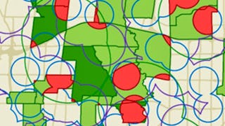
Skills you'll gain: Geographic Information Systems, Geospatial Information and Technology, GIS Software, Geospatial Mapping, Spatial Data Analysis, Spatial Analysis, Global Positioning Systems, Data Analysis, Data Integration, Decision Support Systems
University of Toronto
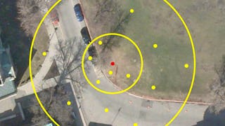
Skills you'll gain: Spatial Data Analysis, Spatial Analysis, Geographic Information Systems, Geospatial Mapping, ArcGIS, Geospatial Information and Technology, GIS Software, Data Manipulation, Data Synthesis, Data Visualization, Data Compilation, Interactive Data Visualization, Data Processing, Data Wrangling, Data Mapping, Data Storytelling, Metadata Management, Data Integration, Graphic and Visual Design, Data Management
University of Toronto
Skills you'll gain: Geographic Information Systems, Geospatial Information and Technology, Geospatial Mapping, GIS Software, Data Mapping, Spatial Data Analysis, Metadata Management, Quantitative Research, Spatial Analysis, Typography, Data Cleansing, Data Manipulation, Design Elements And Principles, Data Import/Export

Coursera
Skills you'll gain: Metadata Management, Technical Documentation, Document Management, Geospatial Information and Technology, Data Validation, Spatial Data Analysis, Geographic Information Systems, Geospatial Mapping, Data Quality, Data Management, File Management, Quality Assurance, Data Integrity, Project Planning, Geometric Dimensioning And Tolerancing

Skills you'll gain: Augmented Reality, Augmented and Virtual Reality (AR/VR), User Experience, Virtual Reality, User Experience Design, UI/UX Strategy, User Interface and User Experience (UI/UX) Design, Experience Design, Usability, Human Computer Interaction, Virtual Environment, Interaction Design, User Interface (UI), Display Devices, User Interface (UI) Design, User Research

Coursera
Skills you'll gain: Interactive Data Visualization, Data Visualization, Heat Maps, Spatial Data Analysis, Geospatial Information and Technology, Data Visualization Software, Technical Communication, Geospatial Mapping, Data Mapping, Interactive Design, Hypertext Markup Language (HTML), GitHub, Usability, Public Health, Document Management

Coursera
Skills you'll gain: Geospatial Information and Technology, Environmental Monitoring, Image Analysis, Spatial Analysis, Environmental Science, Data Validation, Data Preprocessing, Data Collection, Data Analysis, Analytical Skills, Network Monitoring, Data Integrity
Skills you'll gain: Spatial Data Analysis, GIS Software, Geospatial Information and Technology, Spatial Analysis, Geographic Information Systems, Geospatial Mapping, Interactive Data Visualization, User Interface (UI), Application Development, UI Components, Python Programming, Application Design, Data Science, Cross Platform Development, Code Reusability, Application Deployment, User Interface (UI) Design, Software Installation

Skills you'll gain: Augmented Reality, TikTok, Animations, Scripting, Debugging, No-Code Development, Interaction Design, Digital Publishing, Computational Logic
In summary, here are 10 of our most popular spatial coordinates courses
- Introdução ao Geoprocessamento Aplicado: Instituto Tecnológico de Aeronáutica
- Data Visualization with Tableau: Tableau Learning Partner
- Geographical Information Systems - Part 1: École Polytechnique Fédérale de Lausanne
- GIS Mastery: Spatial Data, Remote Sensing, Decision Support: Coursera
- GIS, Mapping, and Spatial Analysis Capstone: University of Toronto
- GIS Data Acquisition and Map Design: University of Toronto
- Manage Geo Projects : Coursera
- UX for Augmented Reality: An Introduction for Designers: Skillshare
- Build Interactive Maps: Coursera
- Start Remote Sensing: Coursera


