Geospatial Courses
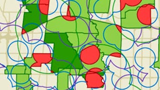
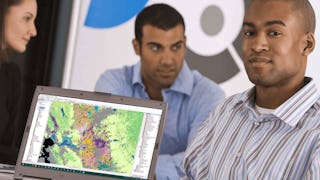
Geospatial courses can help you learn geographic information systems (GIS), remote sensing, spatial analysis, and cartography. You can build skills in data visualization, location-based analysis, and interpreting spatial data. Many courses introduce tools like ArcGIS, QGIS, and Google Earth, that support mapping and analyzing geographic data. You may also explore applied areas such as urban planning, environmental monitoring, and disaster management, providing practical insights into how geospatial techniques impact various industries.
Popular Geospatial Courses and Certifications
 Status: NewStatus: Free Trial
Skills you'll gain: Model Evaluation, Spatial Analysis, Spatial Data Analysis, Geostatistics, Geospatial Mapping, Model Training, Geospatial Information and Technology, Geographic Information Systems, Applied Machine Learning, Image Analysis, Feature Engineering, Machine Learning Methods, Deep Learning, Convolutional Neural Networks, Machine Learning, Data Processing, Fine-tuning, Data Analysis, Random Forest Algorithm
 Status: Free Trial
University of Toronto
Skills you'll gain: Spatial Data Analysis, Spatial Analysis, Geographic Information Systems, Geospatial Mapping, ArcGIS, Geospatial Information and Technology, GIS Software, Data Manipulation, Data Visualization, Data Compilation, Interactive Data Visualization, Data Processing, Data Wrangling, Data Mapping, Data Storytelling, Metadata Management, Data Integration, Graphic and Visual Design, Design Elements And Principles
 Status: NewStatus: Free Trial
Coursera
Skills you'll gain: Spatial Data Analysis, Geospatial Mapping, Geospatial Information and Technology, Geographic Information Systems, Spatial Analysis, Model Evaluation, Image Analysis, Image Quality, Data Analysis, Data Literacy, Analytical Skills, Technical Communication, Process Validation, Data Sharing, Cloud Applications
 Status: Free Trial
University of California, Davis
Skills you'll gain: ArcGIS, GIS Software, Geographic Information Systems, Public Health and Disease Prevention, Public Health, Land Management, Geospatial Information and Technology, Geospatial Mapping, Spatial Analysis, Epidemiology, Community Health, Spatial Data Analysis, Land Development, Social Determinants Of Health, Emergency Response, Environmental Science, Natural Resource Management, Emergency Services, Business Development, Environment and Resource Management
 Status: NewStatus: Free Trial
Madecraft
Skills you'll gain: Plotly, Interactive Data Visualization, Data Visualization, Data Visualization Software, Data Presentation, Statistical Visualization, Data Storytelling, Dashboard Creation, Dashboard, Scatter Plots, Graphing, Diagram Design, Python Programming, Geospatial Information and Technology
 Status: Preview
Universitat de Barcelona
Skills you'll gain: Hydrology, Physical Science, Water Resources, Geospatial Information and Technology, Environmental Monitoring, Chemistry, Environment, Environmental Science, Biology, Climate Change Mitigation
 Status: NewStatus: Free Trial
Università di Napoli Federico II
Skills you'll gain: Robotics, Data Mapping, Model Optimization, Systems Thinking, Problem Solving, Analytical Skills
 Status: Free Trial
University of Toronto
Skills you'll gain: Geographic Information Systems, Geospatial Information and Technology, Geospatial Mapping, GIS Software, Data Mapping, Spatial Data Analysis, Metadata Management, Quantitative Research, Data Literacy, Spatial Analysis, Typography, Data Cleansing, Data Manipulation, Graphic and Visual Design, Design Elements And Principles, Data Import/Export, File Management
 Status: Free Trial
Case Western Reserve University
Skills you'll gain: Geostatistics, Exploratory Data Analysis, Spatial Analysis, Spatial Data Analysis, Geospatial Information and Technology, Data Cleansing, Data Analysis, Statistical Modeling, Statistical Analysis, Oil and Gas, Statistical Reporting, Estimation, Simulations, Simulation and Simulation Software, Data Integration
 Status: NewStatus: Free Trial
Coursera
Skills you'll gain: Data Visualization, Datamaps, Data Presentation, Data Mapping, Color Theory, Design, Visual Design, Graphic and Visual Design, Layout Design, Design Elements And Principles, Geospatial Mapping, Design Strategies

Skills you'll gain: Geospatial Information and Technology, Geospatial Mapping, Spatial Data Analysis, Applied Machine Learning, Geographic Information Systems, GIS Software, Spatial Analysis, Environmental Monitoring, Machine Learning Methods, Unsupervised Learning, Data Analysis Software, Image Analysis, Machine Learning, R Programming, Data Processing, Data Preprocessing, Classification Algorithms, Data Transformation, Dimensionality Reduction, Data Import/Export
 Status: NewStatus: Free Trial
Coursera
Skills you'll gain: Spatial Data Analysis, Spatial Analysis, Geographic Information Systems, GIS Software, Geospatial Mapping, Geospatial Information and Technology, Geostatistics, Data Validation, Pandas (Python Package), Data Analysis, Data Transformation, Data Mapping, Verification And Validation, Geometric Dimensioning And Tolerancing
In summary, here are 10 of our most popular geospatial courses
- Spatial Analysis, 3D Data & Machine Learning: Coursera
- GIS, Mapping, and Spatial Analysis Capstone: University of Toronto
- Process SAR & Multispectral: Coursera
- GIS Applications Across Industries: University of California, Davis
- Data Visualizations with Plotly: Madecraft
- Oceanography: a key to better understand our world: Universitat de Barcelona
- Robotic Technologies: Università di Napoli Federico II
- GIS Data Acquisition and Map Design: University of Toronto
- Case Studies in Geostatistical Modeling: Case Western Reserve University
- Design Stunning Maps: Coursera


