Geospatial Courses
Geospatial courses can help you learn geographic information systems (GIS), remote sensing, spatial analysis, and cartography. You can build skills in data visualization, location-based analysis, and interpreting spatial data. Many courses introduce tools like ArcGIS, QGIS, and Google Earth, that support mapping and analyzing geographic data. You may also explore applied areas such as urban planning, environmental monitoring, and disaster management, providing practical insights into how geospatial techniques impact various industries.
Popular Geospatial Courses and Certifications

University of Illinois Urbana-Champaign
Skills you'll gain: Geospatial Information and Technology, Geographic Information Systems, Apache Hadoop, Spatial Data Analysis, Geospatial Mapping, Spatial Analysis, Big Data, Matplotlib, Data Processing, Computational Thinking, Distributed Computing, Data Manipulation, Theoretical Computer Science, Python Programming

Case Western Reserve University
Skills you'll gain: Geostatistics, Exploratory Data Analysis, Spatial Analysis, Spatial Data Analysis, Geospatial Information and Technology, Data Cleansing, Data Analysis, Statistical Modeling, Statistical Analysis, Oil and Gas, Statistical Reporting, Estimation, Simulations, Simulation and Simulation Software, Data Integration
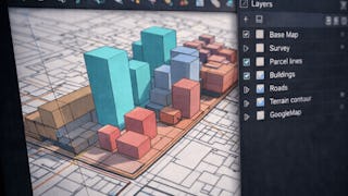
Skills you'll gain: SketchUp (3D Modeling Software), Spatial Data Analysis, Architectural Drawing, Geospatial Mapping, Spatial Analysis, AutoCAD, Visualization (Computer Graphics), Data Mapping, Graphic and Visual Design, 3D Modeling, Technical Communication, Color Theory, Microsoft Office

Johns Hopkins University
Skills you'll gain: Data Visualization Software, Interactive Data Visualization, Geospatial Information and Technology, Geospatial Mapping, Color Theory, Spatial Data Analysis, Tree Maps, Data Storytelling, Tableau Software, Data Mapping, Text Mining, Unstructured Data, Network Analysis, Graph Theory

Coursera
Skills you'll gain: Spatial Data Analysis, Spatial Analysis, Geographic Information Systems, GIS Software, Geospatial Mapping, Geospatial Information and Technology, Geostatistics, Data Validation, Data Transformation, Data Mapping, Verification And Validation, Geometric Dimensioning And Tolerancing
Skills you'll gain: ArcGIS, GIS Software, Spatial Data Analysis, Data Visualization, Geographic Information Systems, Geospatial Information and Technology, Geospatial Mapping, Spatial Analysis, Data Import/Export, Data Mapping, Data Integration, Data Management

University of Colorado Boulder
Skills you'll gain: Data Visualization Software, Tableau Software, Data Visualization, Statistical Visualization, Geospatial Information and Technology, Data Analysis, Geospatial Mapping, Business Analytics, Graphing, Data Presentation, Advanced Analytics, Marketing Analytics, Data Science, Forecasting

Universidad de los Andes
Skills you'll gain: Spatial Analysis, Spatial Data Analysis, Geospatial Mapping, Geographic Information Systems, Geospatial Information and Technology, GIS Software, Environmental Monitoring, Image Analysis, Python Programming, Software Installation

Università di Napoli Federico II
Skills you'll gain: Spatial Data Analysis, Data Integration, Spatial Analysis, Geospatial Mapping, Tableau Software, Data Presentation, Data Visualization Software, Data Mapping, Data Manipulation, Interactive Data Visualization, Data Transformation

Skills you'll gain: Spatial Data Analysis, Spatial Analysis, Geographic Information Systems, Geospatial Information and Technology, Geospatial Mapping, GIS Software, Data Analysis, Data Visualization, Analytics, Interactive Data Visualization, Google Cloud Platform, Network Analysis, Query Languages

Skills you'll gain: SAS (Software), Forecasting, Spatial Data Analysis, Data Visualization Software, Data Mapping, Interactive Data Visualization, Time Series Analysis and Forecasting, Trend Analysis, Predictive Analytics, Geospatial Mapping, Data Analysis, Geospatial Information and Technology, Data Wrangling, Geographic Information Systems, Advanced Analytics, Analytics, Data Transformation, Statistical Programming

University of California, Davis
Skills you'll gain: Data Visualization, Advanced Analytics, Statistical Visualization, Tableau Software, Interactive Data Visualization, Data Visualization Software, Graphing, Data Mapping, Analytics, Predictive Analytics, Histogram, Scatter Plots, Exploratory Data Analysis, Geospatial Mapping, Data Analysis, Forecasting
In summary, here are 10 of our most popular geospatial courses
- Getting Started with CyberGIS: University of Illinois Urbana-Champaign
- Case Studies in Geostatistical Modeling : Case Western Reserve University
- Apply Urban Scale Mapping Techniques Using SketchUp: EDUCBA
- Advanced Techniques in Data Visualization: Johns Hopkins University
- Crunch Vectors with GeoPandas: Coursera
- ArcGIS for Beginners: Mapping Urban Green Spaces: Coursera
- Advanced Visualizations using Tableau: University of Colorado Boulder
- Modelaje y Análisis con información georreferenciada: Universidad de los Andes
- Data Visualization e manipolazione dei dati con Tableau: Università di Napoli Federico II
- Getting Started with BigQuery GIS for Data Analysts: Google Cloud


