Cartography Courses
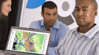
Cartography courses can help you learn map design, spatial analysis, data visualization, and geographic information systems (GIS). You can build skills in interpreting topographic features, understanding coordinate systems, and applying cartographic principles to create effective visual representations. Many courses introduce tools like ArcGIS and QGIS, that support analyzing geographic data and producing detailed maps that communicate information clearly.
Popular Cartography Courses and Certifications
 Status: Preview
École Polytechnique Fédérale de Lausanne
Skills you'll gain: Geographic Information Systems, GIS Software, Geospatial Information and Technology, Spatial Data Analysis, Spatial Analysis, NoSQL, Data Modeling, Database Design, Data Store, Databases, Data Storage Technologies, Database Systems, SQL, Data Storage, Query Languages, Relational Databases
 Status: Preview
École Polytechnique Fédérale de Lausanne
Skills you'll gain: Geographic Information Systems, Data Modeling, GIS Software, SQL, Geospatial Information and Technology, Database Design, Spatial Data Analysis, Geospatial Mapping, Database Management, Spatial Analysis, Geostatistics, Query Languages, Relational Databases, Database Development, Database Software, Land Management, Data Store, Environmental Science, Data Capture, Data Manipulation
 Status: Free Trial
Skills you'll gain: Customer experience improvement, Journey Mapping, Generative AI, Customer Insights, AI Personalization, Customer Analysis, ChatGPT, Customer experience strategy (CX), Data-Driven Marketing, Real Time Data, AI Integrations, Analysis, Design
 Status: Preview
California Institute of the Arts
Skills you'll gain: Typography, Graphic and Visual Design, Graphic Design, Graphic and Visual Design Software, Visual Design, Design, Design Elements And Principles, Creative Design, Visual Storytelling, Computer Graphic Techniques, Color Theory, Creativity
 Status: Free Trial
Skills you'll gain: Video Editing, Video Production, Videography, Photo/Video Production and Technology, Cinematography, Storytelling, Visual Storytelling
 Status: Free Trial
University of California, Davis
Skills you'll gain: ArcGIS, GIS Software, Geographic Information Systems, Public Health and Disease Prevention, Public Health, Land Management, Geospatial Information and Technology, Geospatial Mapping, Spatial Analysis, Epidemiology, Community Health, Spatial Data Analysis, Land Development, Social Determinants Of Health, Emergency Response, Environmental Science, Natural Resource Management, Emergency Services, Business Development, Environment and Resource Management
 Status: NewStatus: Free Trial
Coursera
Skills you'll gain: Content Marketing, Content Strategy, Journey Mapping, Content Development and Management, Target Audience, Persona Development, Blogs, Content Performance Analysis, Marketing Strategies, Content Creation, Marketing Planning, Conversion Funnel Analysis, Content Management, Consumer Behaviour, Auditing, Media Buying, Web Analytics and SEO
 Status: Free Trial
University of Michigan
Skills you'll gain: Sustainable Development, Sustainable Systems, Geographic Information Systems, Geospatial Information and Technology, GIS Software, Geospatial Mapping, Spatial Data Analysis, Datamaps, Sustainability Standards, Spatial Analysis, Interactive Data Visualization, Data Storytelling, Environmental Monitoring, Data Visualization, Data Presentation, Analytical Skills, Analysis, Trend Analysis
 Status: Free Trial
Skills you'll gain: Photography, Geospatial Information and Technology, Geospatial Mapping, Geographic Information Systems, GIS Software, Global Positioning Systems, Spatial Data Analysis, Planning, Research, Critical Thinking, Data Import/Export
 Status: Free Trial
Johns Hopkins University
Skills you'll gain: Rmarkdown, Tidyverse (R Package), Ggplot2, Spatial Data Analysis, Data Visualization Software, Plot (Graphics), Data Visualization, Statistical Visualization, Spatial Analysis, Geospatial Information and Technology, Data Manipulation, Scatter Plots, R (Software), Plotly, Interactive Data Visualization, R Programming, Geospatial Mapping, Statistical Reporting, Data Wrangling, Graphing
 Status: Free Trial
Dassault Systèmes
Skills you'll gain: Drafting and Engineering Design, Engineering Drawings, Technical Drawing, Assembly Drawing, Computer Aided Three-Dimensional Interactive Application (CATIA), 3D Modeling
 Status: Preview
École Polytechnique Fédérale de Lausanne
Skills you'll gain: GIS Software, Spatial Analysis, Geospatial Information and Technology, Geographic Information Systems, Spatial Data Analysis, Geospatial Mapping, Augmented Reality, Data Visualization Software, Data Mapping, Graphic and Visual Design, Color Theory, Database Management
In summary, here are 10 of our most popular cartography courses
- Geographical Information Systems - Part 1: École Polytechnique Fédérale de Lausanne
- Systèmes d’Information Géographique - Partie 1: École Polytechnique Fédérale de Lausanne
- GenAI for Customer Journey Mapping: Coursera
- Fundamentos del Diseño Gráfico: California Institute of the Arts
- Advanced Videography: Cinematic Travel Vlogging: Skillshare
- GIS Applications Across Industries: University of California, Davis
- Map Buyer Journey: Coursera
- GIS: Geographic Information Systems for Sustainability: University of Michigan
- Scout Like a Pro: Find Landscape Photography Locations: Skillshare
- Advanced Data Visualization with R: Johns Hopkins University


