Geospatial Courses
Geospatial courses can help you learn geographic information systems (GIS), remote sensing, spatial analysis, and cartography. You can build skills in data visualization, location-based analysis, and interpreting spatial data. Many courses introduce tools like ArcGIS, QGIS, and Google Earth, that support mapping and analyzing geographic data. You may also explore applied areas such as urban planning, environmental monitoring, and disaster management, providing practical insights into how geospatial techniques impact various industries.
Popular Geospatial Courses and Certifications
 Status: Preview
École Polytechnique Fédérale de Lausanne
Skills you'll gain: Geographic Information Systems, Data Modeling, GIS Software, SQL, Geospatial Information and Technology, Database Design, Spatial Data Analysis, Geospatial Mapping, Database Management, Spatial Analysis, Geostatistics, Query Languages, Relational Databases, Database Development, Database Software, Land Management, Data Store, Environmental Science, Data Capture, Data Manipulation
 Status: Preview
Universitat de Barcelona
Skills you'll gain: Hydrology, Physical Science, Water Resources, Geospatial Information and Technology, Environmental Monitoring, Chemistry, Environment, Environmental Science, Biology, Climate Change Mitigation
 Status: NewStatus: Free Trial
Coursera
Skills you'll gain: GIS Software, Geospatial Mapping, Geographic Information Systems, Spatial Data Analysis, Spatial Analysis, Geospatial Information and Technology, Database Systems, SQL, PostgreSQL, Data Validation, Query Languages, Data Integration, Data Mapping, Scripting, Performance Tuning
 Status: Free Trial
University of California, Davis
Skills you'll gain: Spatial Analysis, ArcGIS, Geospatial Information and Technology, Geographic Information Systems, Geospatial Mapping, GIS Software, Data Quality, Data Mapping, Data Modeling, Database Design, Data Storage Technologies, Data Management, Data Storage, Data Sharing, Data Manipulation, Data Capture, Relational Databases, Query Languages, Analytics
 Status: Free Trial
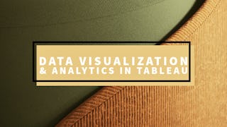
University of Colorado Boulder
Skills you'll gain: Dashboard, Dashboard Creation, Data Visualization Software, Tableau Software, Data Visualization, Statistical Visualization, Interactive Data Visualization, Data Storytelling, Geospatial Information and Technology, Data Literacy, Data Presentation, Data Analysis, Graphing, Color Theory, Advanced Analytics, Data Integration, Business Analytics, Marketing Analytics, Analytics, Forecasting
 Status: Preview
École Polytechnique Fédérale de Lausanne
Skills you'll gain: Geographic Information Systems, GIS Software, Geospatial Information and Technology, Spatial Data Analysis, Spatial Analysis, NoSQL, Data Modeling, Database Design, Data Store, Databases, Data Storage Technologies, Database Systems, SQL, Data Storage, Query Languages, Relational Databases
 Status: Preview
École Polytechnique Fédérale de Lausanne
Skills you'll gain: Spatial Analysis, Spatial Data Analysis, GIS Software, Geospatial Information and Technology, Geographic Information Systems, Geospatial Mapping, Geostatistics, Interactive Data Visualization, Data Integration, Data Mapping, Augmented Reality, Statistical Analysis, Sampling (Statistics)
 Status: NewStatus: Free Trial
Knowledge Accelerators
Skills you'll gain: Power BI, Data Presentation, Dashboard Creation, Microsoft Excel, Dashboard, Excel Formulas, Business Intelligence Software, Data Modeling, Datamaps, Business Reporting, Data Sharing, Data Entry, Data Analysis, Management Reporting, Geospatial Information and Technology, Data Storytelling, Data-Driven Decision-Making, Analytics, Trend Analysis, Data Management
 Status: Preview
École Polytechnique Fédérale de Lausanne
Skills you'll gain: Spatial Data Analysis, Geospatial Mapping, Geospatial Information and Technology, Geographic Information Systems, Geostatistics, Spatial Analysis, GIS Software, Land Development, Global Positioning Systems, 3D Modeling, Data Mapping, Engineering, Scientific, and Technical Instruments, Survey Creation, Engineering Calculations, Trigonometry, Systems Of Measurement, Numerical Analysis
 Status: Preview
Skills you'll gain: Geographic Information Systems, Geospatial Information and Technology, GIS Software, Geospatial Mapping, Spatial Data Analysis, Spatial Analysis, Global Positioning Systems, Data Analysis, Data Integration, Decision Support Systems
 Status: NewStatus: Free Trial
Skills you'll gain: Data Visualization, Geospatial Information and Technology, Interactive Data Visualization, Scientific Visualization, Data Visualization Software, Geospatial Mapping, Geographic Information Systems, Graphic and Visual Design, Environmental Monitoring, Spatial Data Analysis, Design Elements And Principles, Generative AI, Color Theory, AI Workflows
 Status: NewStatus: Free Trial
Skills you'll gain: Model Evaluation, Spatial Analysis, Spatial Data Analysis, Geostatistics, Geospatial Mapping, Model Training, Geospatial Information and Technology, Geographic Information Systems, Applied Machine Learning, Image Analysis, Feature Engineering, Machine Learning Methods, Deep Learning, Convolutional Neural Networks, Machine Learning, Data Processing, Fine-tuning, Data Analysis, Random Forest Algorithm
In summary, here are 10 of our most popular geospatial courses
- Systèmes d’Information Géographique - Partie 1: École Polytechnique Fédérale de Lausanne
- Oceanography: a key to better understand our world: Universitat de Barcelona
- Desktop GIS & Spatial Databases: Coursera
- GIS Data Formats, Design and Quality: University of California, Davis
- Data Visualization & Analytics in Tableau: University of Colorado Boulder
- Geographical Information Systems - Part 1: École Polytechnique Fédérale de Lausanne
- Geographical Information Systems - Part 2: École Polytechnique Fédérale de Lausanne
- Excel to Power BI: Data Analysis & Business Intelligence: Knowledge Accelerators
- Éléments de Géomatique: École Polytechnique Fédérale de Lausanne
- GIS Mastery: Spatial Data, Remote Sensing, Decision Support: Coursera


