When you enroll in this course, you'll also be enrolled in this Specialization.
Learn new concepts from industry experts
Gain a foundational understanding of a subject or tool
Develop job-relevant skills with hands-on projects
Earn a shareable career certificate
There are 4 modules in this course
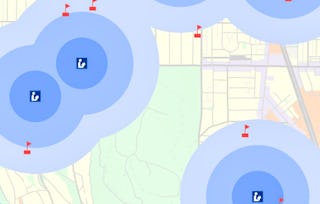
Explore the world of spatial analysis and cartography with geographic information systems (GIS). In this class you will learn the basics of the industry’s leading software tool, ArcGIS, during four week-long modules:
Week 1: Learn how GIS grew from paper maps to the globally integrated electronic software packages of today. You will install ArcGIS on your computer and learn how to use online help to answer technical questions.
Week 2: Open up ArcGIS and explore data using ArcMap. Learn the foundational concepts of GIS, how to analyze data, and make your first map.
Week 3: Make your own maps! Symbolize data and create an eye-catching final product.
Week 4: Share your data and maps and learn to store and organize your data.
Take Fundamentals of GIS as a standalone course or as part of the Geographic Information Systems (GIS) Specialization. By completing the first class in the Specialization you will gain the skills needed to succeed in the full program.
Students who need an ArcGIS license will receive a non-commercial, 1 year student license for participation in this course and specialization.
In this module, we will cover course expectations, give you a quick overview of GIS and what's great about it, take a first look at ArcGIS Pro and identify key elements in the interface, and define core geospatial concepts and terminology. In Section 2, we will discuss options for desktop GIS, the history of GIS and how it's used today, discuss resources and help that you can use, and lay out core skills that are relevant to you as a GIS analyst.
What's included
17 videos3 readings2 assignments
Show info about module content
17 videos•Total 91 minutes
Course Overview•2 minutes
Module 1 Overview•1 minute
Why GIS is Awesome•7 minutes
What is GIS? - Part 1•6 minutes
What is GIS? - Part 2•7 minutes
A First Look at GIS Software - Part 1•5 minutes
A First Look at GIS Software - Part 2•7 minutes
GIS Terminology to Know - Part 1•5 minutes
GIS Terminology to Know - Part 2•5 minutes
Tour of ArcGIS Pro - Part 1•6 minutes
Tour of ArcGIS Pro - Part 2•6 minutes
Tour of ArcGIS Pro - Part 3•6 minutes
Data Representation in GIS•7 minutes
Desktop GIS Software Packages•4 minutes
Getting Help with GIS - Part 1•6 minutes
Getting Help with GIS - Part 2•6 minutes
Relevant Skills for the GIS Analyst•7 minutes
3 readings•Total 31 minutes
Course Navigation and Safety Statement•1 minute
Glossary of Terms•15 minutes
Resources and Help for GIS•15 minutes
2 assignments•Total 60 minutes
Lesson 1: Knowledge Check•30 minutes
Lesson 2 Knowledge Check•30 minutes
ArcGIS Basics
Module 2•7 hours to complete
Module details
In this module, we'll start out by showing you how to get a copy of ArcGIS Pro for this course, and with a tutorial on getting started in ArcGIS. Then, we will explore GIS data using ArcMap and will explore and change properties of GIS layers to change map displays. We will subset data using selections, and explore feature attributes. Finally, we will learn about projections and use that knowledge as we run geoprocessing tools.
Using ArcGIS Pro to Explore Data - Part 1•6 minutes
Using ArcGIS Pro to Explore Data - Part 2•6 minutes
Using ArcGIS Pro to Explore Data - Part 3•7 minutes
Viewing and Changing Layer Properties - Part 1•6 minutes
Viewing and Changing Layer Properties - Part 2•6 minutes
Viewing and Changing Layer Properties - Part 3•5 minutes
Using Feature Classes and Attribute Tables - Part 1•7 minutes
Using Feature Classes and Attribute Tables - Part 2•6 minutes
Using Feature Classes and Attribute Tables - Part 3•6 minutes
Selections•7 minutes
An Introduction to Projections•9 minutes
Geoprocessing, Environment Settings, and Spatial Joins - Part 1•3 minutes
Geoprocessing, Environment Settings, and Spatial Joins - Part 2•4 minutes
Geoprocessing, Environment Settings, and Spatial Joins - Part 3•2 minutes
Assignment 2 Overview•1 minute
2 readings•Total 210 minutes
How to Install ArcGIS Pro•30 minutes
Practice Assignment: Introduction to ArcMap (Part 2)•180 minutes
3 assignments•Total 127 minutes
Lesson 3 Knowledge Check•30 minutes
Lesson 4 Knowledge Check•7 minutes
Introduction to ArcGIS Pro - Guided Practice•90 minutes
1 app item•Total 5 minutes
Getting Your Copy of ArcGIS Pro•5 minutes
1 discussion prompt•Total 15 minutes
Spatial Joins•15 minutes
Making Maps With Common Datasets
Module 3•6 hours to complete
Module details
In this module we will identify common datasets in both the US and Internationally. We will use a new mode in ArcGIS to create complete maps that include proper symbology, legends, titles, north arrows, and data sources. We will further use more advanced mapping techniques to output map books and label items on the map.
What's included
19 videos1 reading2 assignments
Show info about module content
19 videos•Total 106 minutes
Module 3 Overview•1 minute
Finding Common Datasets•7 minutes
Using Layout View to Make Maps - Part 1•7 minutes
Using Layout View to Make Maps - Part 2•7 minutes
Using Map Elements - Part 1•6 minutes
Using Map Elements - Part 2•6 minutes
Using Map Elements - Part 3•5 minutes
Using Map Elements - Part 4•5 minutes
Symbology: Changing How Your Data Looks•5 minutes
Symbology Examples•8 minutes
Setting Up Symbology in ArcGIS Pro - Part 1•6 minutes
Setting Up Symbology in ArcGIS Pro - Part 2•7 minutes
Setting Up Symbology in ArcGIS Pro - Part 3•5 minutes
Labeling Map Features - Part 1•7 minutes
Labeling Map Features - Part 2•6 minutes
Labeling Map Features - Part 3•6 minutes
Making Map Books - Part 1•6 minutes
Making Map Books - Part 2•6 minutes
Assignment 3 Overview•1 minute
1 reading•Total 180 minutes
Practice Assignment: Laying Out and Exporting Maps•180 minutes
2 assignments•Total 60 minutes
Lesson 5 Quiz•30 minutes
Lesson 6 Quiz •30 minutes
Retrieving and Sharing Data
Module 4•5 hours to complete
Module details
In this module, we will view and edit metadata in order to create higher quality data. We will retrieve data from the web and share data, discuss workspaces and file formats, and create layer and map packages. We will also use multiple file formats for GIS data and be able to appropriately choose between them based upon project requirements.
What's included
15 videos1 reading2 assignments1 peer review
Show info about module content
15 videos•Total 64 minutes
Module 4 Overview•2 minutes
Using Metadata to Document Data Products•7 minutes
Creating and Uploading Packages with ArcGIS Pro - Part 1•5 minutes
Creating and Uploading Packages with ArcGIS Pro - Part 2•5 minutes
Creating and Uploading Packages with ArcGIS Pro - Part 3•5 minutes
Importing Map Packages•5 minutes
Choosing a Data Format - Part 1•4 minutes
Choosing a Data Format - Part 2•5 minutes
Joins and Relates - Part 1•4 minutes
Joins and Relates - Part 2•6 minutes
Joins and Relates - Part 3•4 minutes
Troubleshooting ArcGIS Pro - Part 1•4 minutes
Troubleshooting ArcGIS Pro - Part 2•5 minutes
Practice Assignment Overview•2 minutes
Course Summary•1 minute
1 reading•Total 120 minutes
Area Impacted by Wildfire Assignment Instructions•120 minutes
2 assignments•Total 60 minutes
Lesson 7 Quiz •30 minutes
Lesson 8 Quiz•30 minutes
1 peer review•Total 60 minutes
Practice Assignment: Wildfire Impacted Areas •60 minutes
Earn a career certificate
Add this credential to your LinkedIn profile, resume, or CV. Share it on social media and in your performance review.
Instructor
Instructor ratings
Instructor ratings
We asked all learners to give feedback on our instructors based on the quality of their teaching style.
UC Davis, one of the nation’s top-ranked research universities, is a global leader in agriculture, veterinary medicine, sustainability, environmental and biological sciences, and technology. With four colleges and six professional schools, UC Davis and its students and alumni are known for their academic excellence, meaningful public service and profound international impact.
OK
Explore more from Environmental Science and Sustainability
"To be able to take courses at my own pace and rhythm has been an amazing experience. I can learn whenever it fits my schedule and mood."
Jennifer J.
Learner since 2020
"I directly applied the concepts and skills I learned from my courses to an exciting new project at work."
Larry W.
Learner since 2021
"When I need courses on topics that my university doesn't offer, Coursera is one of the best places to go."
Chaitanya A.
"Learning isn't just about being better at your job: it's so much more than that. Coursera allows me to learn without limits."
Learner reviews
4.8
5,913 reviews
5 stars
86.39%
4 stars
10.88%
3 stars
1.38%
2 stars
0.42%
1 star
0.91%
Showing 3 of 5913
A
AW
5·
Reviewed on Apr 30, 2018
Excellent fundamental course. Easy to follow although Nick does talk a little fast at times, you can always pause and go back. Really fun and interactive way to get started in GIS. Cheers!
O
OY
5·
Reviewed on Aug 25, 2019
It was a very good opportunity to learn GIS. Now, I have an idea about the power of GIS and it was totally fun to complete course quizzes and assignments. I strongly recommend the course!
A
AR
5·
Reviewed on Aug 9, 2020
This course helps to understand the basics of ArcGIS desktop and a web GIS career. Though it does not discuss all these features, a peer can certainly kickstart a GIS career with this course.
You'll learn how GIS is used to understand location-based data and turn it into clear, useful maps. The course starts with core ideas like GIS terminology and how spatial data is represented, then builds into data exploration, map design, and sharing organized GIS work. Along the way, you'll practice tasks like analyzing layer attributes, creating map layouts, and packaging maps for others to use.
Do I need any GIS background before starting?
No, you don't need prior GIS experience. It begins with the basics of what GIS is, how the software works, and how to install and navigate ArcGIS, and learners who need access can receive a non-commercial one-year student license. Some general computer comfort, especially with installing desktop software and working with files in Windows, will make the early setup easier.
Is this course beginner-friendly for GIS?
Yes, this course is beginner-friendly if you're looking for a true introduction to GIS. It explains the key terms, shows you how to move around the software, and uses guided practice before asking you to create maps or run analysis tools on your own. It may feel more demanding if you're not comfortable installing software or managing files on your computer.
How long does it take to complete this course?
It's about 23 hours in total. At roughly 10 hours a week, that works out to around 2 to 3 weeks, though the content itself is organized as four modules. The course includes lessons, readings, quizzes, guided practice, and a peer-reviewed mapping assignment.
Are there hands-on exercises or projects in this course?
Yes, there's a meaningful amount of hands-on work, and most of it is guided. You'll create projects in ArcGIS Pro, add and explore datasets, work with attributes and selections, and build map layouts with labels, legends, and other map elements. The course then asks you to bring those steps together in a peer-reviewed wildfire mapping assignment, so you apply each skill in context.
What skills and topics are covered in this course?
The course covers core GIS concepts, desktop GIS workflow, cartography, and data management. You'll learn how to work with layers and attribute tables, use common analysis tools such as selections and spatial joins, and design maps with symbology, labels, and map series. It also introduces metadata, file formats, and sharing, so you're learning how GIS projects are built, organized, and communicated.
What can I actually do after finishing this course?
By the end, you should be able to open and organize GIS data, inspect attributes, run basic geoprocessing, and produce a finished map that others can read and use. One concrete example from the course is analyzing wildfire perimeter data by county and presenting the results in a complete map layout. That's a solid outcome for straightforward desktop GIS tasks, even though it isn't an advanced analysis course.
Is this course more focused on theory or hands-on learning?
It leans hands-on, but in a guided way. After the opening concepts, much of the course is spent using GIS software to explore data, change map appearance, run tools, and export results. It's a good fit if you want software practice more than a purely conceptual overview.
Why would I choose this course over other GIS courses?
This course is a strong choice if you want a beginner GIS class that follows the full desktop workflow rather than stopping at definitions or map styling alone. It takes you from basic concepts and software setup through data exploration, analysis, map layout, metadata, and sharing, with guided practice at each stage and a final peer-reviewed wildfire map. If you want one course that connects GIS ideas to the actual steps of producing and sharing map outputs, this one fits well.