Cartography Courses
Cartography courses can help you learn map design, spatial analysis, data visualization, and geographic information systems (GIS). You can build skills in interpreting topographic features, understanding coordinate systems, and applying cartographic principles to create effective visual representations. Many courses introduce tools like ArcGIS and QGIS, that support analyzing geographic data and producing detailed maps that communicate information clearly.
Popular Cartography Courses and Certifications

Skills you'll gain: Photography, Visual Storytelling, Storytelling, Photo/Video Production and Technology, Design Elements And Principles, Creativity

Skills you'll gain: Photography, Photo/Video Production and Technology, Creativity, Visual Storytelling, Storytelling, Aesthetics
Michigan State University
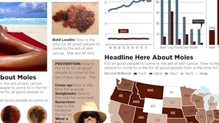
Skills you'll gain: Infographics, Adobe Illustrator, Graphic and Visual Design, Diagram Design, Graphic Design, Visual Design, Typography, Layout Design, Design Elements And Principles, Visual Storytelling, Graphical Tools, Storytelling, Color Theory

Johns Hopkins University
Skills you'll gain: Rmarkdown, Tidyverse (R Package), Ggplot2, Spatial Data Analysis, Data Visualization Software, Plot (Graphics), Data Visualization, Statistical Visualization, Spatial Analysis, Geospatial Information and Technology, Data Manipulation, Scatter Plots, R (Software), Plotly, Interactive Data Visualization, R Programming, Geospatial Mapping, Statistical Reporting, Data Wrangling, Graphing

California Institute of the Arts
Skills you'll gain: Graphic Design, Typography, Graphic and Visual Design, Graphic and Visual Design Software, Design Elements And Principles, Adobe Creative Cloud, Color Theory, Visual Design, Design Software, Digital Design, Creative Design, Adobe Illustrator, Adobe Photoshop, Layout Design
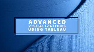
University of Colorado Boulder
Skills you'll gain: Data Visualization Software, Tableau Software, Data Visualization, Statistical Visualization, Geospatial Information and Technology, Data Analysis, Geospatial Mapping, Business Analytics, Graphing, Data Presentation, Advanced Analytics, Marketing Analytics, Data Science, Forecasting

Macquarie University
Skills you'll gain: Pivot Tables And Charts, Data Storytelling, Data Presentation, Data Visualization Software, Data Visualization, Interactive Data Visualization, Dashboard Creation, Spreadsheet Software, Dashboard, Microsoft Excel, Excel Macros, Tree Maps, Excel Formulas, Data Analysis, Forecasting, Geospatial Mapping
Logical Operations
Skills you'll gain: Data Storytelling, Data Presentation, Interactive Data Visualization, Dashboard, Datamaps, Data Visualization, Dashboard Creation, Microsoft Excel, Data Visualization Software, Pivot Tables And Charts, Geospatial Information and Technology, Spreadsheet Software, Geospatial Mapping, Data Analysis, Productivity Software, Microsoft Office, Microsoft 365

Coursera
Skills you'll gain: Spatial Data Analysis, Geographic Information Systems, Geospatial Information and Technology, GIS Software, Spatial Analysis, Data Literacy, Data Analysis, Image Analysis, Data Processing, Data Preprocessing, NumPy, Data Validation, Metadata Management, Data Collection, Data Management

Johns Hopkins University
Skills you'll gain: Data Visualization, Data Visualization Software, Storyboarding, Statistical Visualization, Data Storytelling, Data Manipulation, Data Presentation, Statistical Reporting, Data Wrangling, Dashboard, Data Synthesis, Data Cleansing, R Programming, Tidyverse (R Package), Data Preprocessing, Data Transformation, Data Import/Export, Rmarkdown, Graphing

Skills you'll gain: Photography, Geospatial Information and Technology, Geospatial Mapping, Geographic Information Systems, GIS Software, Global Positioning Systems, Spatial Data Analysis, Planning, Research, Critical Thinking, Data Import/Export

The Pennsylvania State University
Skills you'll gain: Geographic Information Systems, Case Studies, Climate Change Programs, Systems Thinking, Geospatial Information and Technology, Sustainable Design, Spatial Analysis, Sustainable Development, Design Strategies, Collaborative Software, Decision Intelligence, Decision Support Systems, Cultural Responsiveness
In summary, here are 10 of our most popular cartography courses
- The Art of Landscape Photography for Beginners: Skillshare
- Street Photography: Foundations & Creative Mindsets : Skillshare
- Design and Make Infographics (Project-Centered Course): Michigan State University
- Advanced Data Visualization with R: Johns Hopkins University
- Grundlagen des Grafikdesigns: California Institute of the Arts
- Advanced Visualizations using Tableau: University of Colorado Boulder
- Data Visualization in Excel: Macquarie University
- Excel: Dashboards and Geospatial Visualizations: Logical Operations
- Decode Rasters with Rasterio: Coursera
- Data Visualization Capstone: Johns Hopkins University


