Geography Courses
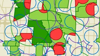
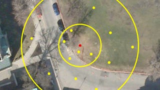
Geography courses can help you learn spatial analysis, cartography, environmental systems, and urban planning. You can build skills in geographic information systems (GIS), data visualization, and understanding demographic trends. Many courses introduce tools like ArcGIS and QGIS, that support mapping and analyzing geographic data, as well as methods for interpreting spatial relationships and patterns.
Popular Geography Courses and Certifications
 Status: Preview
École Polytechnique Fédérale de Lausanne
Skills you'll gain: Spatial Analysis, Spatial Data Analysis, GIS Software, Geospatial Information and Technology, Geographic Information Systems, Geospatial Mapping, Geostatistics, Interactive Data Visualization, Data Integration, Data Mapping, Augmented Reality, Statistical Analysis, Sampling (Statistics)
 Status: Free Trial
University of Toronto
Skills you'll gain: Spatial Data Analysis, Spatial Analysis, Geographic Information Systems, Geospatial Mapping, ArcGIS, Geospatial Information and Technology, GIS Software, Data Manipulation, Data Visualization, Data Compilation, Interactive Data Visualization, Data Processing, Data Wrangling, Data Mapping, Data Storytelling, Metadata Management, Data Integration, Graphic and Visual Design, Design Elements And Principles
 Status: Preview
École Polytechnique Fédérale de Lausanne
Skills you'll gain: GIS Software, Spatial Analysis, Geospatial Information and Technology, Geographic Information Systems, Geospatial Mapping, Spatial Data Analysis, Augmented Reality, Data Visualization Software, Data Mapping, Graphic and Visual Design, Color Theory, Database Management
 Status: Free Trial
University of Toronto
Skills you'll gain: Geographic Information Systems, Geospatial Information and Technology, Geospatial Mapping, GIS Software, Data Mapping, Spatial Data Analysis, Metadata Management, Quantitative Research, Data Literacy, Spatial Analysis, Typography, Data Cleansing, Data Manipulation, Graphic and Visual Design, Design Elements And Principles, Data Import/Export, File Management
 Status: Preview
O.P. Jindal Global University
Skills you'll gain: Environment, Environmental Issue, Environmental Science, Environmental Resource Management, Environment and Resource Management, Pollution Prevention, Mitigation, Social Studies, Sustainable Systems, Sustainable Development, Climate Change Adaptation, Climate Change Mitigation, Biology, Social Sciences, Natural Resource Management, Environment Health And Safety, Life Sciences
 Status: Free Trial
L&T EduTech
Skills you'll gain: Geospatial Information and Technology, Spatial Analysis, Geographic Information Systems, Spatial Data Analysis, GIS Software, Database Management, Database Management Systems, ArcGIS, Relational Databases, Data Modeling, Data Mapping, Data Import/Export, Open Source Technology, Web Applications, Mobile Development
 Status: Free Trial
L&T EduTech
Skills you'll gain: Civil Engineering, Construction Engineering, Traffic Flow Optimization, Construction, Design Specifications, Engineering Software, Engineering Design Process, Structural Analysis, Materials science, Engineering Analysis, Laboratory Testing, Analytical Testing
 Status: Preview
École Polytechnique Fédérale de Lausanne
Skills you'll gain: Spatial Data Analysis, Geospatial Mapping, Geospatial Information and Technology, Geographic Information Systems, Geostatistics, Spatial Analysis, GIS Software, Land Development, Global Positioning Systems, 3D Modeling, Data Mapping, Engineering, Scientific, and Technical Instruments, Survey Creation, Engineering Calculations, Trigonometry, Systems Of Measurement, Numerical Analysis
 Status: NewStatus: Free Trial
Coursera
Skills you'll gain: Spatial Data Analysis, GIS Software, Geographic Information Systems, Spatial Analysis, Query Languages, SQL, Geospatial Information and Technology, PostgreSQL, Database Development, Performance Tuning
 Status: Preview
Skills you'll gain: Geographic Information Systems, Geospatial Information and Technology, GIS Software, Geospatial Mapping, Spatial Data Analysis, Spatial Analysis, Global Positioning Systems, Data Analysis, Data Integration, Decision Support Systems
 Status: Preview
University of Geneva
Skills you'll gain: Climate Change Adaptation, Water Resources, Climate Change Programs, Water Resource Management, Hydrology, Environmental Resource Management, Risk Management, Water Quality, Water Sustainability, Mitigation, Natural Resource Management, Environment, Climate Change Mitigation, Sustainable Development, Social Impact, Social Sciences, Hazard Analysis, Social Network Analysis, Physical Science, Governance
 Status: Free Trial
Rice University
Skills you'll gain: Biology, Microbiology, Life Sciences, Molecular, Cellular, and Microbiology, Environment, Environmental Science, Infectious Diseases, Molecular Biology, Cell Biology, Taxonomy
In summary, here are 10 of our most popular geography courses
- Geographical Information Systems - Part 2: École Polytechnique Fédérale de Lausanne
- GIS, Mapping, and Spatial Analysis Capstone: University of Toronto
- Systèmes d’Information Géographique - Partie 2: École Polytechnique Fédérale de Lausanne
- GIS Data Acquisition and Map Design: University of Toronto
- Introduction to Environmental Science: O.P. Jindal Global University
- Geospatial Information Technology Essentials: L&T EduTech
- Highway Geometry and Pavement Design: L&T EduTech
- Éléments de Géomatique: École Polytechnique Fédérale de Lausanne
- Query Spatial with PostGIS: Coursera
- GIS Mastery: Spatial Data, Remote Sensing, Decision Support: Coursera


