QGIS Courses
QGIS courses can help you learn geographic information systems, spatial analysis, data visualization, and cartography techniques. You can build skills in managing geographic data, creating detailed maps, and analyzing spatial relationships. Many courses introduce tools like QGIS software, which allows you to manipulate and visualize geospatial data effectively, along with methods for conducting field surveys and integrating various data sources.
Popular QGIS Courses and Certifications
 Status: Free Trial
University of California, Davis
Skills you'll gain: ArcGIS, Data Storytelling, GIS Software, Spatial Data Analysis, Data Presentation, Geographic Information Systems, Spatial Analysis, Geospatial Mapping, Geospatial Information and Technology, Heat Maps, Data Visualization Software, Network Analysis, Data Manipulation, Network Routing
 Status: Preview
Yonsei University
Skills you'll gain: Spatial Data Analysis, Spatial Analysis, Geospatial Information and Technology, Geographic Information Systems, Geospatial Mapping, GIS Software, Database Management Systems, Big Data, Database Systems, Apache Hadoop, Data Modeling, PostgreSQL, Network Analysis
 Status: Free Trial
L&T EduTech
Skills you'll gain: Geospatial Information and Technology, Spatial Analysis, GIS Software, Spatial Data Analysis, Geographic Information Systems, Geospatial Mapping, Construction Engineering, Database Management, Database Management Systems, Construction, Construction Management, ArcGIS, Relational Databases, Visualization (Computer Graphics), Global Positioning Systems, Data Mapping, Building Information Modeling, Scientific Visualization, Engineering, Scientific, and Technical Instruments, Network Analysis
 Status: Free Trial
University of Toronto
Skills you'll gain: Geographic Information Systems, Geospatial Information and Technology, Geospatial Mapping, GIS Software, Data Mapping, Spatial Data Analysis, Metadata Management, Quantitative Research, Data Literacy, Spatial Analysis, Typography, Data Cleansing, Data Manipulation, Graphic and Visual Design, Design Elements And Principles, Data Import/Export, File Management
 Status: Free Trial
University of California, Davis
Skills you'll gain: Spatial Analysis, ArcGIS, Geospatial Information and Technology, Geographic Information Systems, Geospatial Mapping, GIS Software, Data Quality, Data Mapping, Data Modeling, Database Design, Data Storage Technologies, Data Management, Data Storage, Data Sharing, Data Manipulation, Data Capture, Relational Databases, Query Languages, Analytics
 Status: Free Trial
Case Western Reserve University
Skills you'll gain: Exploratory Data Analysis, Spatial Data Analysis, Spatial Analysis, Geospatial Mapping, Geospatial Information and Technology, Descriptive Statistics, Statistical Modeling, R Programming, Statistical Analysis, R (Software), Probability & Statistics, Statistical Programming, Data-Driven Decision-Making, Data Analysis, Simulations, Statistical Methods, Rmarkdown, Data Cleansing, Box Plots, Plot (Graphics)
 Status: NewStatus: Free Trial
Skills you'll gain: Leaflet (Software), Data Visualization, Extract, Transform, Load, Interactive Data Visualization, Datamaps, Data Pipelines, Analytical Skills, Data Presentation, Amazon S3, Dashboard Creation, Amazon Web Services, Spatial Data Analysis, Heat Maps, Apache Airflow, GIS Software, Geographic Information Systems, Metadata Management, Technical Documentation, Geospatial Mapping, Cloud Computing
 Status: Free Trial
Vanderbilt University
Skills you'll gain: LLM Application, Large Language Modeling, Project Planning, Prompt Patterns, ChatGPT, Risk Analysis, Timelines, Project Risk Management, Performance Metric, Project Schedules, Project Management, Organizational Skills, Prompt Engineering, Risk Management, Key Performance Indicators (KPIs), Generative AI
 Status: Preview
École Polytechnique Fédérale de Lausanne
Skills you'll gain: Geographic Information Systems, Data Modeling, GIS Software, SQL, Geospatial Information and Technology, Database Design, Spatial Data Analysis, Geospatial Mapping, Database Management, Spatial Analysis, Geostatistics, Query Languages, Relational Databases, Database Development, Database Software, Land Management, Data Store, Environmental Science, Data Capture, Data Manipulation
 Status: Free Trial
University of California, Davis
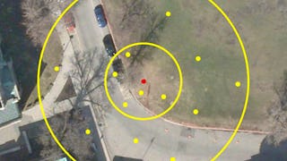
Skills you'll gain: ArcGIS, GIS Software, Geographic Information Systems, Public Health and Disease Prevention, Public Health, Land Management, Geospatial Information and Technology, Geospatial Mapping, Spatial Analysis, Epidemiology, Community Health, Spatial Data Analysis, Land Development, Social Determinants Of Health, Emergency Response, Environmental Science, Natural Resource Management, Emergency Services, Business Development, Environment and Resource Management
 Status: Free Trial
Logical Operations
Skills you'll gain: Data Storytelling, Data Presentation, Interactive Data Visualization, Dashboard, Datamaps, Data Visualization, Dashboard Creation, Microsoft Excel, Data Visualization Software, Pivot Tables And Charts, Geospatial Information and Technology, Spreadsheet Software, Geospatial Mapping, Data Analysis, Productivity Software, Microsoft 365
 Status: Preview
Skills you'll gain: Geographic Information Systems, Geospatial Information and Technology, GIS Software, Geospatial Mapping, Spatial Data Analysis, Spatial Analysis, Global Positioning Systems, Data Analysis, Data Integration, Decision Support Systems
In summary, here are 10 of our most popular qgis courses
- Geospatial Analysis with ArcGIS: University of California, Davis
- Spatial Data Science and Applications: Yonsei University
- Geospatial Techniques for Engineers: L&T EduTech
- GIS Data Acquisition and Map Design: University of Toronto
- GIS Data Formats, Design and Quality: University of California, Davis
- Practical Geospatial Geostatistical Modeling: Case Western Reserve University
- Geospatial Visualization, Cloud & Real-Time Pipelines: Coursera
- ChatGPT for Project Management: Insight, Planning, & Success: Vanderbilt University
- Systèmes d’Information Géographique - Partie 1: École Polytechnique Fédérale de Lausanne
- GIS Applications Across Industries: University of California, Davis


