Geospatial Courses
Geospatial courses can help you learn geographic information systems (GIS), remote sensing, spatial analysis, and cartography. You can build skills in data visualization, location-based analysis, and interpreting spatial data. Many courses introduce tools like ArcGIS, QGIS, and Google Earth, that support mapping and analyzing geographic data. You may also explore applied areas such as urban planning, environmental monitoring, and disaster management, providing practical insights into how geospatial techniques impact various industries.
Popular Geospatial Courses and Certifications
 Status: Preview
The Pennsylvania State University
Skills you'll gain: Geographic Information Systems, Case Studies, Climate Change Programs, Systems Thinking, Geospatial Information and Technology, Sustainable Design, Spatial Analysis, Sustainable Development, Design Strategies, Collaborative Software, Decision Intelligence, Decision Support Systems, Cultural Responsiveness
 Status: Free Trial
University of California, Davis
Skills you'll gain: Data Visualization, Advanced Analytics, Tableau Software, Data Visualization Software, Graphing, Data Mapping, Predictive Analytics, Histogram, Scatter Plots, Exploratory Data Analysis, Geospatial Mapping, Data Analysis, Forecasting
 Status: NewStatus: Free Trial
Skills you'll gain: Node.JS, Cloud Deployment, MongoDB, Role-Based Access Control (RBAC), Application Deployment, Server Side, Back-End Web Development, Restful API, Application Programming Interface (API), Redis, Authorization (Computing), API Testing, Authentications, NoSQL, Security Controls, Performance Tuning, Secure Coding, Geospatial Information and Technology, Scalability, Performance Testing
 Status: Free Trial
University of California, Irvine
Skills you'll gain: Dashboard Creation, Dashboard, Data Storytelling, Data Presentation, Interactive Data Visualization, Data Visualization Software, Tableau Software, Market Data, Geospatial Information and Technology, Data Analysis, Analytical Skills, Application Deployment, Network Analysis, Financial Data, Financial Analysis
 Status: Free Trial
Skills you'll gain: Ggplot2, Data Visualization Software, Data Visualization, Statistical Visualization, Rmarkdown, Shiny (R Package), Plot (Graphics), Dashboard Creation, Dashboard, Leaflet (Software), Interactive Data Visualization, Data Presentation, R (Software), R Programming, Scatter Plots, Graphing, Box Plots, Geospatial Information and Technology, Data Science, Data Analysis
 Status: Free Trial
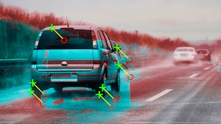
Skills you'll gain: Computer Vision, Image Analysis, Model Evaluation, Model Training, Deep Learning, Matlab, Machine Learning Methods, Data Preprocessing, Machine Learning, Classification Algorithms, Machine Learning Algorithms, Transfer Learning, Anomaly Detection, Geospatial Information and Technology, Traffic Flow Optimization, Algorithms
 Status: Free Trial
Johns Hopkins University
Skills you'll gain: Rmarkdown, Shiny (R Package), Ggplot2, Tidyverse (R Package), Data Visualization, Spatial Data Analysis, Statistical Visualization, Dashboard Creation, Scatter Plots, Plot (Graphics), Dashboard, R (Software), Data Import/Export, Interactive Data Visualization, R Programming, Data Visualization Software, Spatial Analysis, Geospatial Information and Technology, Data Science, Data Analysis
 Status: Free Trial
Skills you'll gain: Power Electronics, Thermal Management, Electrical Safety, Electrical Power, Electric Power Systems, Electronic Systems, Electrical Equipment, Electrical Systems, Embedded Software, Electronic Components, Energy and Utilities, HVAC, Basic Electrical Systems, Sustainable Technologies, Automation, Environmental Issue, Environment and Resource Management, Environmental Regulations, Environmental Engineering and Restoration, Geospatial Information and Technology
 Status: Free Trial
Skills you'll gain: Keras (Neural Network Library), Deep Learning, PyTorch (Machine Learning Library), Computer Vision, Machine Learning, Python Programming
 Status: Free Trial
Microsoft
Skills you'll gain: Data Storytelling, Dashboard, Dashboard Creation, Power BI, Data Presentation, Data Visualization, Interactive Data Visualization, Data Visualization Software, Microsoft Power Platform, Creative Design, Data-Driven Decision-Making, Data Analysis, Design, Design Elements And Principles, Geospatial Mapping
 Status: Preview
University of Illinois Urbana-Champaign
Skills you'll gain: Energy and Utilities, Spatial Data Analysis, Environmental Issue, Geospatial Information and Technology, Environment and Resource Management, Environmental Science, Geographic Information Systems, Oil and Gas, Environmental Resource Management, Natural Resource Management, Sustainable Systems, Petroleum Industry, Physical Science, Environment, Hydrology, Laboratory Experience, Hazard Analysis
 Status: Free Trial
Macquarie University
Skills you'll gain: Pivot Tables And Charts, Data Storytelling, Data Presentation, Data Visualization Software, Data Visualization, Interactive Data Visualization, Dashboard Creation, Spreadsheet Software, Dashboard, Microsoft Excel, Excel Macros, Tree Maps, Excel Formulas, Data Analysis, Forecasting, Geospatial Mapping
In summary, here are 10 of our most popular geospatial courses
- Geodesign: Change Your World: The Pennsylvania State University
- Visual Analytics with Tableau: University of California, Davis
- Node.js Backend Security, Performance and Optimization: LearnKartS
- Dashboarding and Deployment: University of California, Irvine
- Data Visualization with R: IBM
- Computer Vision for Engineering and Science: MathWorks
- Data Visualization & Dashboarding with R: Johns Hopkins University
- Electric Vehicle Systems and Technologies: Coursera
- AI Capstone Project with Deep Learning: IBM
- Creative Designing in Power BI: Microsoft


