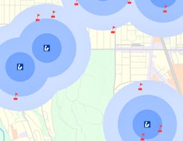
Explore the world of spatial analysis and cartography with geographic information systems (GIS). In this class you will learn the basics of the industry’s leading software tool, ArcGIS, during four week-long modules:


Fundamentals of GIS
This course is part of Geographic Information Systems (GIS) Specialization
Taught in English
Some content may not be translated


Instructors: Nick Santos
Top Instructor
164,319 already enrolled
Included with 
Course
(5,520 reviews)
97%
Recommended experience
What you'll learn
Define core geospatial concepts
Practice with subset data using selections and feature attributes
Create map books using advanced mapping techniques
Create layer and map packages
Skills you'll gain
Details to know

Add to your LinkedIn profile
9 quizzes
Course
(5,520 reviews)
97%
Recommended experience
See how employees at top companies are mastering in-demand skills

Build your subject-matter expertise
- Learn new concepts from industry experts
- Gain a foundational understanding of a subject or tool
- Develop job-relevant skills with hands-on projects
- Earn a shareable career certificate


Earn a career certificate
Add this credential to your LinkedIn profile, resume, or CV
Share it on social media and in your performance review

There are 4 modules in this course
In this module, we will cover course expectations, give you a quick overview of GIS and what's great about it, take a first look at ArcGIS Pro and identify key elements in the interface, and define core geospatial concepts and terminology. In Section 2, we will discuss options for desktop GIS, the history of GIS and how it's used today, discuss resources and help that you can use, and lay out core skills that are relevant to you as a GIS analyst. We'll close out by showing you how to get a copy of ArcGIS Pro for this course, and with a tutorial on getting started in ArcGIS.
What's included
14 videos4 readings2 quizzes1 app item2 discussion prompts
In this module, we will explore GIS data using ArcMap and will explore and change properties of GIS layers to change map displays. We will subset data using selections, and explore feature attributes. Finally, we will learn about projections and use that knowledge as we run geoprocessing tools.
What's included
10 videos1 reading2 quizzes3 discussion prompts
In this module we will identify common datasets in both the US and Internationally. We will use a new mode in ArcGIS to create complete maps that include proper symbology, legends, titles, north arrows, and data sources. We will further use more advanced mapping techniques to output map books and label items on the map.
What's included
11 videos1 reading2 quizzes2 discussion prompts
In this module, we will view and edit metadata in order to create higher quality data. We will retrieve data from the web and share data, discuss workspaces and file formats, and create layer and map packages. We will also use multiple file formats for GIS data and be able to appropriately choose between them based upon project requirements.
What's included
10 videos3 readings3 quizzes1 peer review3 discussion prompts
Instructors

Offered by
Recommended if you're interested in Environmental Science and Sustainability

University of California, Davis

University of California, Davis

École Polytechnique Fédérale de Lausanne

University of Toronto
Why people choose Coursera for their career


Learner reviews
Showing 3 of 5520
5,520 reviews
- 5 stars
86.64%
- 4 stars
10.82%
- 3 stars
1.32%
- 2 stars
0.36%
- 1 star
0.85%

Open new doors with Coursera Plus
Unlimited access to 7,000+ world-class courses, hands-on projects, and job-ready certificate programs - all included in your subscription
Advance your career with an online degree
Earn a degree from world-class universities - 100% online
Join over 3,400 global companies that choose Coursera for Business
Upskill your employees to excel in the digital economy
Frequently asked questions
This course and the next course in the specialization have sessions that begin weekly, so if you miss a session or fall behind, you can enroll when you're ready. Courses each take about 4 weeks to complete, depending on the pace you follow. Later courses run slightly less frequently, from every 2 weeks to every month based on enrollment. The capstone project runs approximately every 8 weeks in order to ensure enough students are in the course to give feedback and grades. The capstone project also takes longer (recommended time is about 8 weeks).
This course currently uses ArcMap and requires a computer running Windows. A license for ArcGIS is provided in the course. Learners on Mac or Unix systems can still participate, but must set up Windows somewhere, such as in BootCamp, Parallels, or another virtual machine, in order to install ArcGIS.
In the near-future we will be transitioning the course to teach ArcGIS Pro and QGIS together, so you'd be able to use whicher works on your system and based on what you wish to learn.
Access to lectures and assignments depends on your type of enrollment. If you take a course in audit mode, you will be able to see most course materials for free. To access graded assignments and to earn a Certificate, you will need to purchase the Certificate experience, during or after your audit. If you don't see the audit option:
The course may not offer an audit option. You can try a Free Trial instead, or apply for Financial Aid.
The course may offer 'Full Course, No Certificate' instead. This option lets you see all course materials, submit required assessments, and get a final grade. This also means that you will not be able to purchase a Certificate experience.

