Remote Sensing Courses
Remote sensing courses can help you learn about satellite imagery analysis, geographic information systems (GIS), and environmental monitoring techniques. You can build skills in data interpretation, spatial analysis, and remote sensing applications in agriculture and urban planning. Many courses introduce tools like ArcGIS and QGIS, along with software for processing satellite data, that support analyzing and visualizing geographic information.
Popular Remote Sensing Courses and Certifications
 Status: NewStatus: Free Trial
The Expert Academy
Skills you'll gain: Meeting Facilitation, Sales Presentations, Virtual Teams, Sales Presentation, Discussion Facilitation, Communication Strategies, Selling Techniques, Collaborative Software, Presentations, Telecommuting, Communication, Driving engagement, Sales, Concision, Rapport Building, Virtual Networking, Taking Meeting Minutes, Storytelling, Digital Communications
 Status: Free Trial
University of California, Irvine
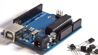
Skills you'll gain: Electronics, Internet Of Things, Electronic Components, Embedded Systems, Basic Electrical Systems, Electronic Hardware, Electrical and Computer Engineering, Wireless Networks, Hardware Design, Peripheral Devices, Electrical Wiring, Control Systems, Human Machine Interfaces, Automation Engineering, Programming Principles, Computer Systems, Computer Programming, Systems Engineering, Remote Access Systems, Interactive Learning
 Status: Free Trial
Skills you'll gain: Financial Statement Analysis, Bookkeeping, Reconciliation, Financial Statements, Fixed Asset, Inventory Control, Depreciation, Payroll, Asset Management, Financial Analysis, Ledgers (Accounting), Financial Accounting, Financial Reporting, Payroll Administration, Inventory Accounting, Accounting, Balance Sheet, Payment Processing and Collection, Financial Acumen, Payroll Processing
 Status: Free Trial
L&T EduTech
Skills you'll gain: Oil and Gas, Petroleum Industry, Environmental Engineering, Environmental Issue, Chemical Engineering, Automation Engineering, Engineering Analysis, Geostatistics, Water Resources, Production Process, Process Engineering, Control Systems, Hydraulics, Geospatial Mapping, Process Analysis, Microbiology
 Status: NewStatus: Free Trial
The Expert Academy
Skills you'll gain: Closing (Sales), Overcoming Objections, Inside Sales, Negotiation, Selling Techniques, Trustworthiness, Customer Retention, Sales Presentation, Collaboration, Sales, Relationship Building, General Sales Practices, Sales Presentations, Customer Relationship Building, Sales Management, Rapport Building, Virtual Networking, Virtual Environment, Digital Communications, Presentations
 Status: Free Trial
University of California San Diego
Skills you'll gain: Session Initiation Protocols, Cloud Development, Android Development, Version Control, Integrated Development Environments, Cloud Applications, Cloud Computing Architecture, GitHub, Cloud Computing, Software Design, Application Development, Systems Design, Android (Operating System), Embedded Software, Internet Of Things, Android Studio, Telecommunications, Mobile Development, Digital Communications, Computer Vision
 Status: Free Trial
Skills you'll gain: Operating System Administration, Package and Software Management, File Systems, Microsoft Windows, Linux, Operating Systems, OS Process Management, Linux Administration, Remote Access Systems, System Monitoring, Command-Line Interface, User Accounts, Systems Administration, System Support, User Provisioning, Technical Support and Services, File Management, Linux Commands, Software Installation, Identity and Access Management
 Status: NewStatus: Free Trial
The Expert Academy
Skills you'll gain: Sales Presentations, Sales Process, Sales Pipelines, Selling Techniques, Virtual Teams, Sales, Presentations, Lead Generation, Workflow Management, Prospecting and Qualification, Sales Strategy, Sales Management, Professional Networking, Driving engagement, Customer Relationship Building, Persuasive Communication, Social Media Campaigns, Communication, Relationship Building, Digital Communications
 Status: Free Trial
Johns Hopkins University
Skills you'll gain: R (Software), Statistical Analysis, R Programming, Statistical Programming, Statistical Methods, Data Analysis, Debugging, Simulations, Program Development, Programming Principles, Software Installation, Data Structures, Performance Tuning, Data Import/Export
 Status: Free Trial
University of Illinois Urbana-Champaign
Skills you'll gain: Revenue Recognition, Peer Review, Credit Risk, Mergers & Acquisitions, Financial Analysis, Accrual Accounting, Financial Statements, Investment Management, Accruals, Cash Flows, Accounting, Corporate Finance, Financial Statement Analysis, Bookkeeping, Financial Accounting, Finance, Financial Modeling, Investments, Financial Management, Risk Management
 Status: NewStatus: Free Trial
Minnesota State University, Mankato
Skills you'll gain: Healthcare Project Management, Stakeholder Analysis, Scheduling, Work Breakdown Structure, Communication Planning, Change Control, Project Planning, Project Management, Project Performance, Performance Metric, Project Schedules, Project Implementation, Project Risk Management, Timelines, Budget Management, Stakeholder Engagement, Budgeting, Stakeholder Management, Risk Management, Change Management
 Status: Free Trial
SkillUp
Skills you'll gain: Virtual Teams, Team Collaboration, Telecommuting, Team Leadership, Team Management, Peer Review, Workplace inclusivity, Rapport Building, Team Building, Coaching, Smart Goals, Accountability Frameworks, Leadership and Management, Teamwork, Collaboration, Drive Engagement, Cross-Functional Collaboration, Diversity and Inclusion, Trustworthiness, Communication
In summary, here are 10 of our most popular remote sensing courses
- Virtual Sales Presentations, Meetings And Influence: The Expert Academy
- Interfacing with the Arduino: University of California, Irvine
- Intuit Academy Bookkeeping: Intuit
- Hydrocarbon Exploration and Production: L&T EduTech
- Virtual Negotiation, Objections And Closing Deals: The Expert Academy
- Internet of Things and AI Cloud: University of California San Diego
- Operating Systems and You: Becoming a Power User: Google
- Virtual Selling Foundations: Prospecting And Engagement: The Expert Academy
- R Programming: Johns Hopkins University
- Financial Management: University of Illinois Urbana-Champaign


