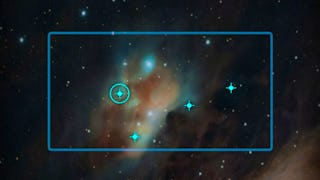
Remote Sensing Courses
Remote sensing courses can help you learn about satellite imagery analysis, geographic information systems (GIS), and environmental monitoring techniques. You can build skills in data interpretation, spatial analysis, and remote sensing applications in agriculture and urban planning. Many courses introduce tools like ArcGIS and QGIS, along with software for processing satellite data, that support analyzing and visualizing geographic information.
Popular Remote Sensing Courses and Certifications
 Status: Free Trial
MathWorks
Skills you'll gain: Image Analysis, Image Quality, Matlab, Computer Vision, Spatial Data Analysis, Environmental Monitoring, Quantitative Research, Graphical Tools, Mathematical Software, File Management
 Status: Free Trial
MathWorks
Skills you'll gain: Image Analysis, Computer Vision, Matlab, Anomaly Detection, Geospatial Information and Technology, Machine Learning Methods, Algorithms
 Status: Free Trial
University of Colorado Boulder
Skills you'll gain: Power Electronics, Electronic Components, Semiconductors, Electric Power Systems, Electrical Systems, Electrical Engineering, Plant Operations and Management, Electronics, Engineering, Scientific, and Technical Instruments, Electronics Engineering, System Monitoring, Energy and Utilities, Electrical Equipment, Safety Assurance, Manufacturing Processes, Design Specifications
 Status: Free Trial
Indian Institute of Science
Skills you'll gain: Chemical and Biomedical Engineering, Biomedical Technology, Biomedical Engineering, Electronics Engineering, Electronics, Semiconductors, Electronic Systems, Biochemistry, Systems Design, Internet Of Things, Materials science, Chemical Engineering, Laboratory Experience, Laboratory Techniques, Manufacturing Processes
 Status: Free
Skills you'll gain: Model Training, Model Evaluation, Image Analysis, Amazon Web Services, Image Quality, Computer Vision, Anomaly Detection, Data Science, Machine Learning, Cloud Computing
 Status: Free Trial
Skills you'll gain: SAS (Software), Forecasting, Spatial Data Analysis, Data Visualization Software, Data Mapping, Interactive Data Visualization, Time Series Analysis and Forecasting, Trend Analysis, Predictive Analytics, Geospatial Mapping, Data Analysis, Geospatial Information and Technology, Data Wrangling, Geographic Information Systems, Advanced Analytics, Analytics, Data Transformation, Statistical Programming
 Status: Free Trial
Technical University of Munich (TUM)
Skills you'll gain: Global Positioning Systems, Digital Transformation, Environmental Monitoring, Manufacturing Processes, Manufacturing and Production, Geospatial Information and Technology, Image Analysis, AI literacy, digital literacy, Cybersecurity, Spatial Data Analysis, Artificial Intelligence, Cyber Risk, Cyber Attacks, Cloud Computing, Data Storage

Duke University
Skills you'll gain: Environmental Monitoring, Environmental Regulations, Environmental Laws, Data Ethics, Environmental Science, Geospatial Information and Technology, Robotics, Ethical Standards And Conduct, Global Positioning Systems, Research, Electronic Components, Critical Thinking
 Status: Free Trial
Skills you'll gain: Computer Vision, Image Analysis, Model Evaluation, Model Training, Deep Learning, Matlab, Machine Learning Methods, Data Preprocessing, Machine Learning, Classification Algorithms, Machine Learning Algorithms, Transfer Learning, Anomaly Detection, Geospatial Information and Technology, Traffic Flow Optimization, Algorithms
 Status: Free Trial
Columbia University
Skills you'll gain: Image Quality, Image Analysis, Computer Vision, Photography, Color Theory, Digital Signal Processing, Semiconductors, Algorithms
 Status: Free Trial
University of Colorado Boulder
Skills you'll gain: Electrical Engineering, electromagnetics, Image Quality, Engineering Calculations, System Requirements, Simulation and Simulation Software, Design Software, Systems Design, System Design and Implementation, Graphical Tools, Applied Mathematics, Physics, Spatial Analysis
 Status: Free Trial
University of Colorado Boulder
Skills you'll gain: Electrical Power, Electrical Equipment, Electrical Systems, Electric Power Systems, Engineering, Scientific, and Technical Instruments, Mechanical Engineering, Machine Controls, Energy and Utilities, Estimation, System Monitoring, Vibrations, Control Systems, Performance Tuning, Engineering Calculations
In summary, here are 10 of our most popular remote sensing courses
- Introduction to Image Processing: MathWorks
- Introduction to Computer Vision: MathWorks
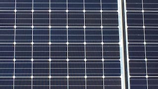
- Solar Power Sensors: University of Colorado Boulder
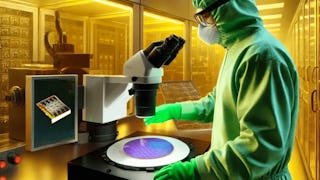
- Fundamentals of Sensors: Indian Institute of Science
- Build Image Quality Inspection using AWS Lookout for Vision: Coursera
- Using Data for Geographic Mapping and Forecasting in SAS Visual Analytics: SAS
- Digitalisation in Space Research: Technical University of Munich (TUM)
- Drones for Environmental Science: Duke University
- Computer Vision for Engineering and Science: MathWorks
- Camera and Imaging: Columbia University


